


Snow covers the land, and all things fall into a state of tranquility. | Kanas - Sai Lake Blue Ice - Swan Spring 11-day Tour
In the winter of northern Xinjiang, the land is a magnificent tapestry of ice and life. When the cold front sweeps across the mountains of the north and south, this vast territory unfolds a breathtaking white landscape: Altay is like a dreamy wonderland, Hemo Village is like a snowy fairy tale, and Kanas is a heavenly paradise on earth. After the snow melts, the golden peaks are bathed in sunlight, and the icicles are crystal clear and beautiful. Walking among them, one forgets all their troubles and is completely immersed in the beauty.
The Snow and Ice Fairyland - My Altay
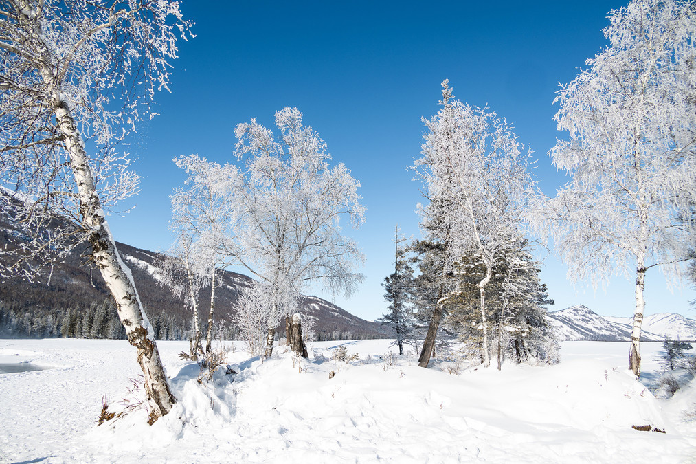
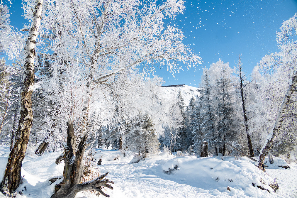
The winter in Altay is like a dreamy and enchanting scene. The endless expanse of snow is captivating, with the forest dressed in a silver coat, the jade-like branches and frosty icicles shining brightly. The tranquility and brightness blend together, and purity and fantasy coexist. Each flying snowflake is like a fairy dancing gracefully in the air. Under the sunlight and the glow of the bonfire, the snowland is not lonely but presents a warm and vigorous dreamlike scene, so beautiful that it leaves one speechless!
Altay belongs to the northern part of Xinjiang Uygur Autonomous Region and is located in the northernmost part of Xinjiang. It borders Russia, Kazakhstan, and Mongolia. The Altay region is under the jurisdiction of the Ili Kazakh Autonomous Prefecture. The Altay region has complex and diverse landforms, mainly divided into mountains, hills, plains, and deserts. The climate is a temperate continental climate, with hot summers and severe winters. The Altay region has 1 county-level city and 6 counties, namely Altay City, Bulijin County, Habahe County, Jimuna County, Fu Yun County, Fuhai County, and Qinghe County.
Altay region has a long history of border defense culture. Since the Western Han Dynasty established the Western Regions Protectorate in 60 BC, the Altay area has been officially incorporated into China's territory.
Altay region is an important node city on the northern channel of the Silk Road Economic Belt and in the construction of the China-Mongolia-Russia Economic Corridor. It has 3 national land border ports and is a relatively humid area in Xinjiang and one of the six major forest areas in China. It is known for its "golden mountains and silver waters", and is one of the origins of skiing in China.
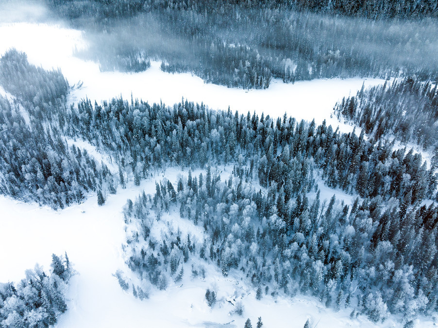
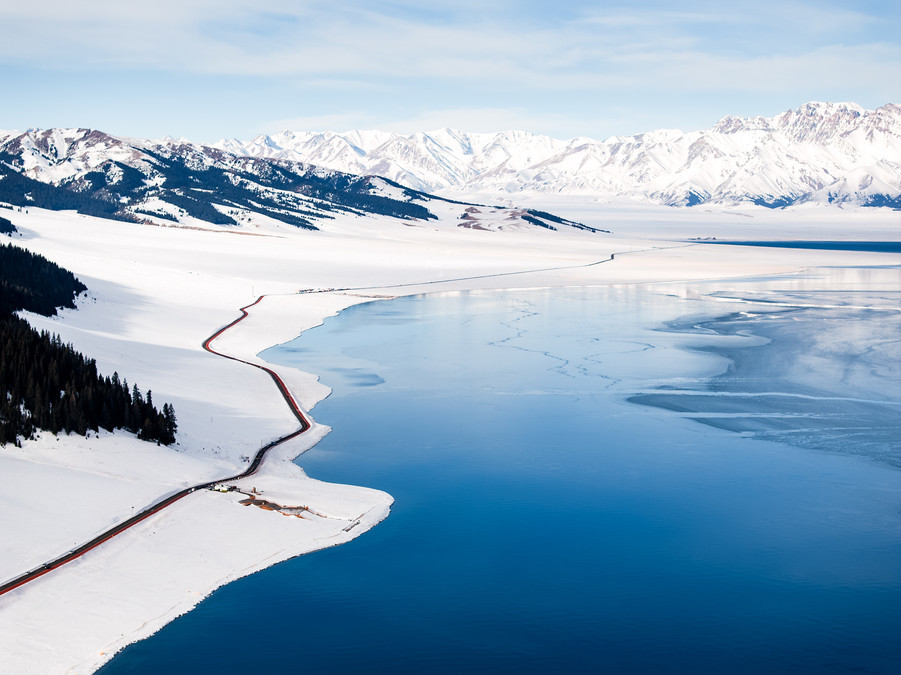
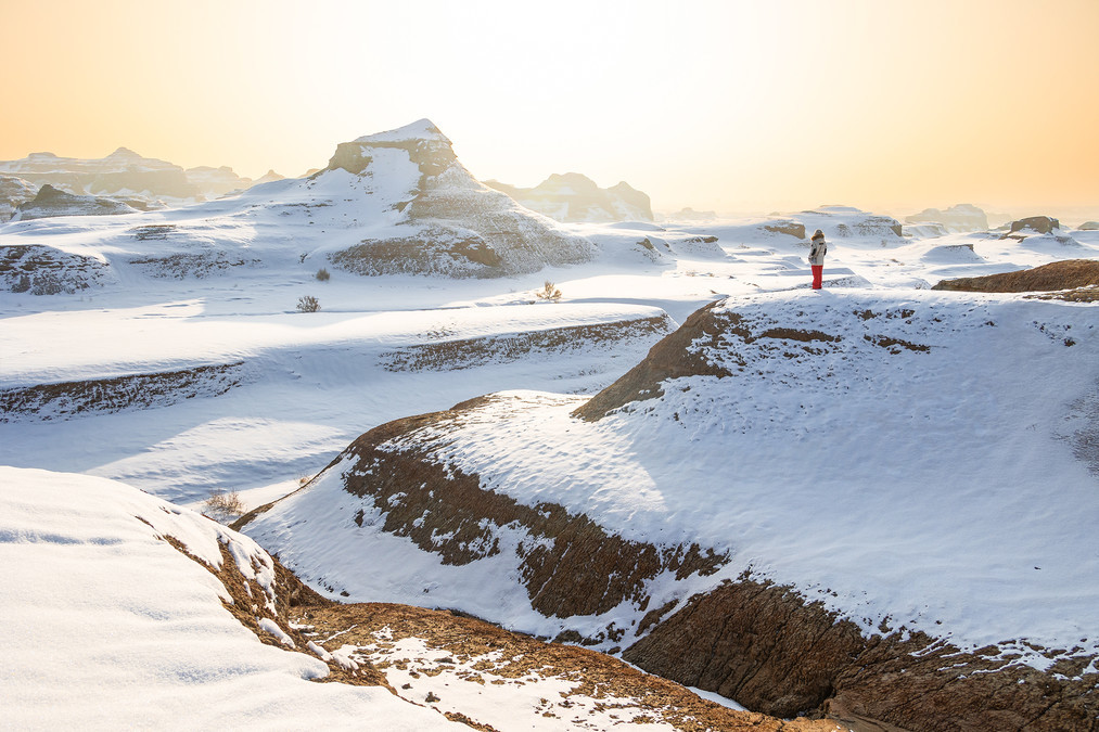
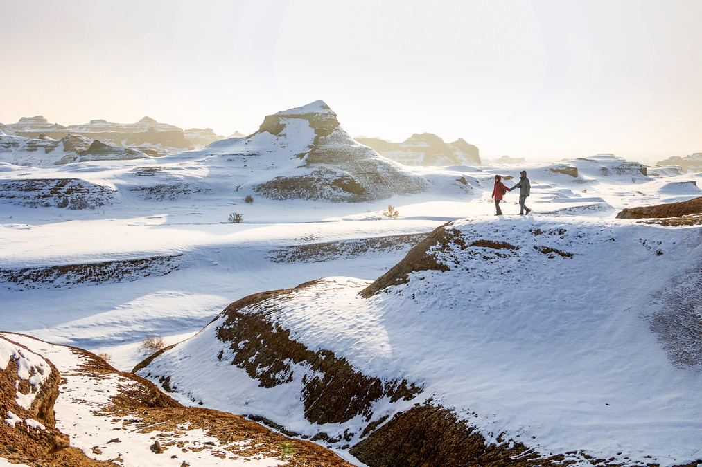
The Kanas scenic area in Altay is located in the middle section of the Altai Mountains in Xinjiang Uygur Autonomous Region. It is located in the border area where China meets Kazakhstan, Russia, and Mongolia. It is the only protected area for Siberian flora and fauna in the western part of the Tianshan Mountains. Now, a Kanas Lake Natural Landscape Reserve has been established centered around Kanas Lake. The total area is 5,588 square kilometers. The reserve is vertically distributed from the glacier and snow belt to the mountainous frozen snow belt, the alpine meadow belt, and the mountainous grassland belt.
"Kanas" is a Mongolian word, meaning "beautiful and rich, mysterious and enigmatic" or "lake in a canyon". Another interpretation is that Kanas means "king's water". It was named after the water here during Genghis Khan's expedition, so it got its name.
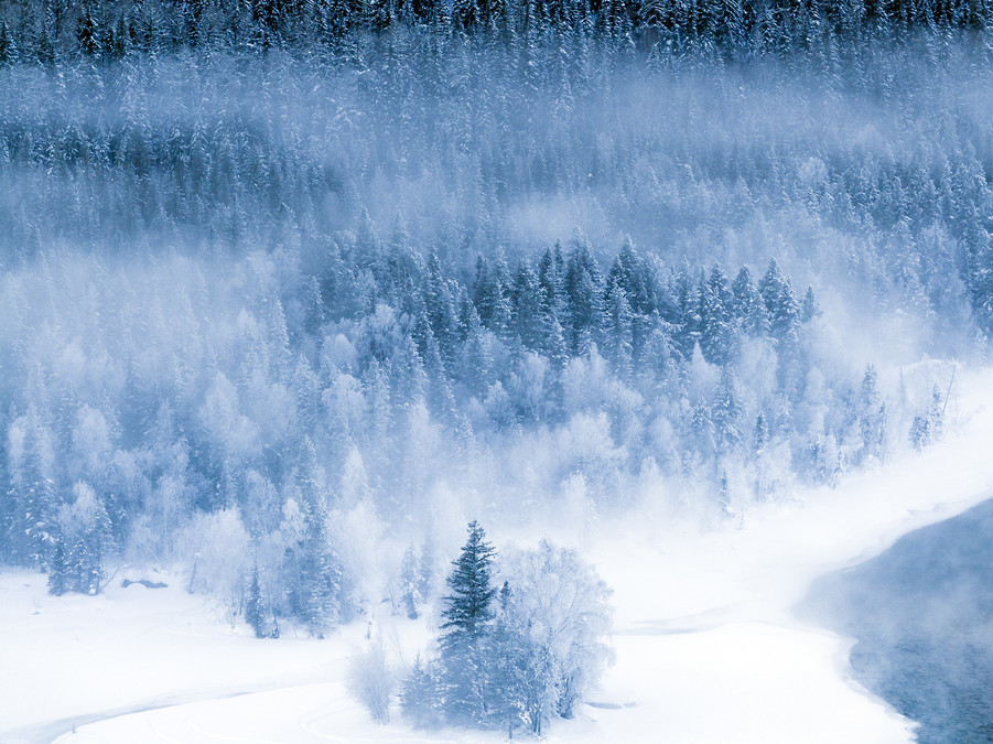
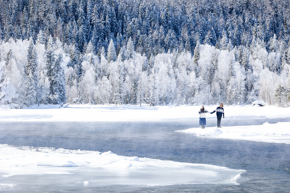
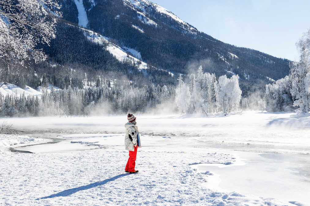
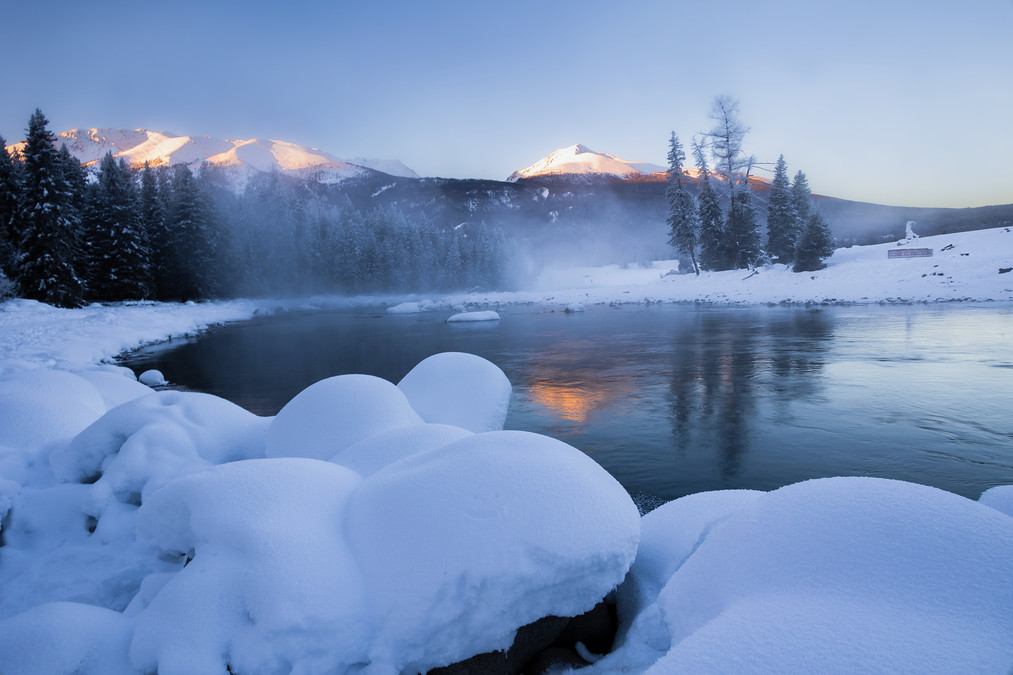
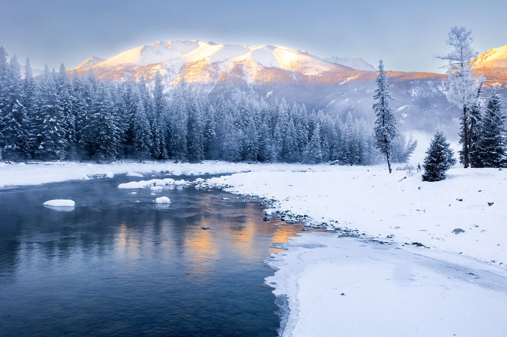
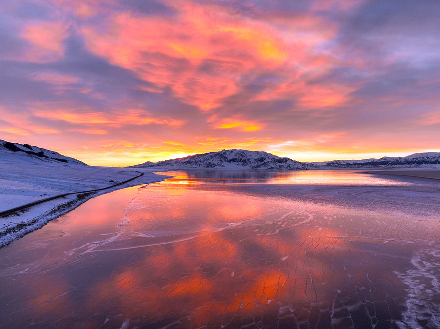
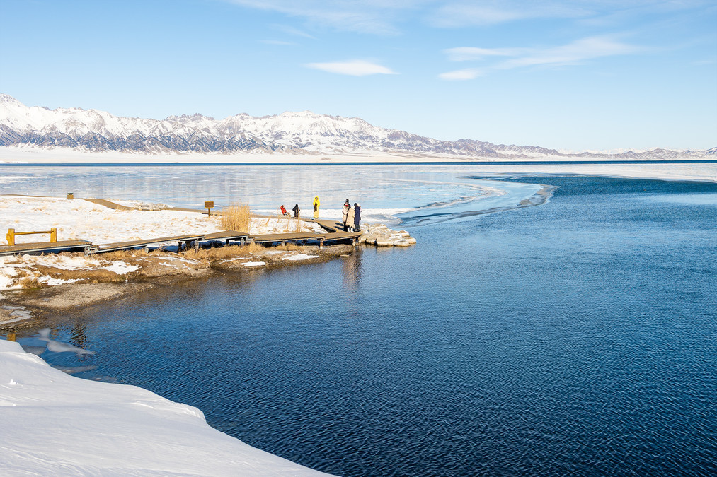
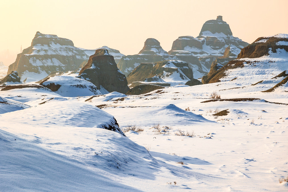
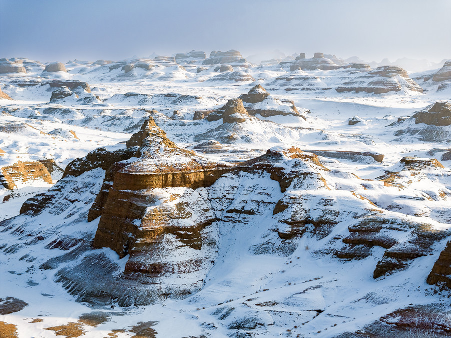
The undulating Altay Mountain Range is like a magnificent ice and snow dragon, bringing a heavenly blessing to the entire area north of the Tianshan Mountains. If Hemo Village in winter is a mysterious and enchanting ice and snow paradise, then Kanas in winter is a breathtaking and captivating earthly wonderland. In March and April, the three bays of Kanas are already covered in ice and snow. The clear lake surface gradually freezes in the ice, and from time to time, a hint of blue lake light peeks out from beneath the snow. The surrounding forest and snow-covered land is vast and pure, bringing a beautiful and healing feeling. (Personally, I like Kanas the most. Whether it's the autumn scenery or the winter view, it is unparalleledly beautiful.)
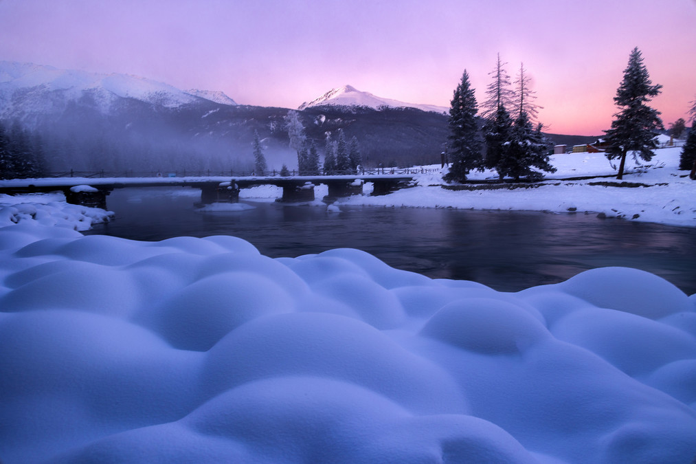
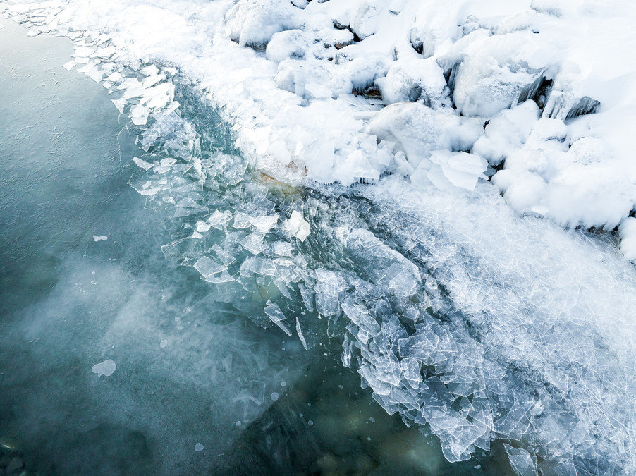
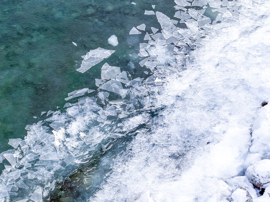
Walking by the lake and listening to the low murmurs of the Kanas water monster beneath the ice, the un-frozen river, carrying tiny blue ice fragments, flows slowly, carrying the misty fog through the snowfield and the riverbank covered with frost flowers. The clear and natural atmosphere can instantly make one forget all their troubles. The pebbles on the shore are piled up layer upon layer, turning into cute snow mushrooms under the cover of snow. This remote northern region, beyond the mundane world, is exactly what I have long yearned for - poetry and the distant land.
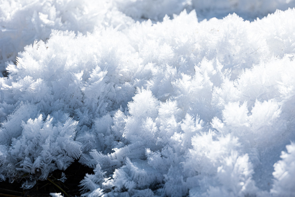
Under the sunlight, the frost flowers shone with a glittering brilliance. From time to time, the mountains and forests swayed, emitting dark green pine resin. The chilly scent of the snowflakes wafted into one's nostrils, seemingly capable of purifying the soul.
Looking down at the frozen Kanas covering an area of three thousand miles, the originally clear and blue lake gradually lost its colors in the solemnity of winter. The simple and plain colors create a minimalist landscape painting, with the magnificent mountains, rivers and dreamy frost scenery forming a peaceful earthly paradise.
The Kanas scenic area in Altay region belongs to the Arctic Ocean water system. Around the lake, there are dense primeval forests, and the sunny slopes are covered with thick grass. The lake water comes from the glacier meltwater of mountains such as Kuitun and Yifangfeng, as well as local precipitation. It flows into the Kanas Lake through the surface or underground.
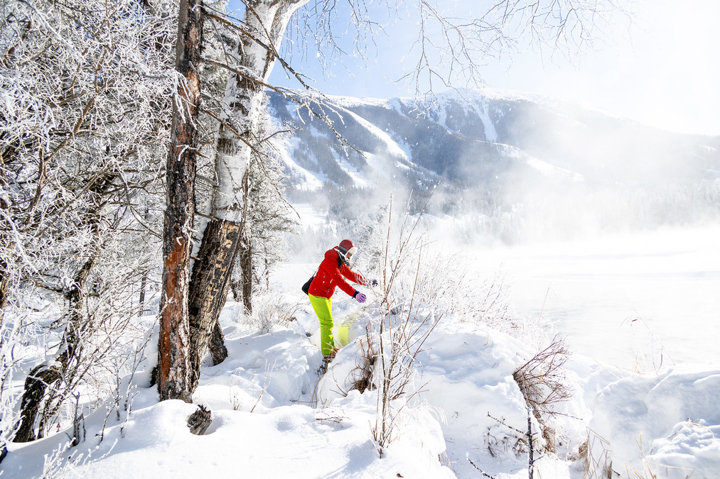
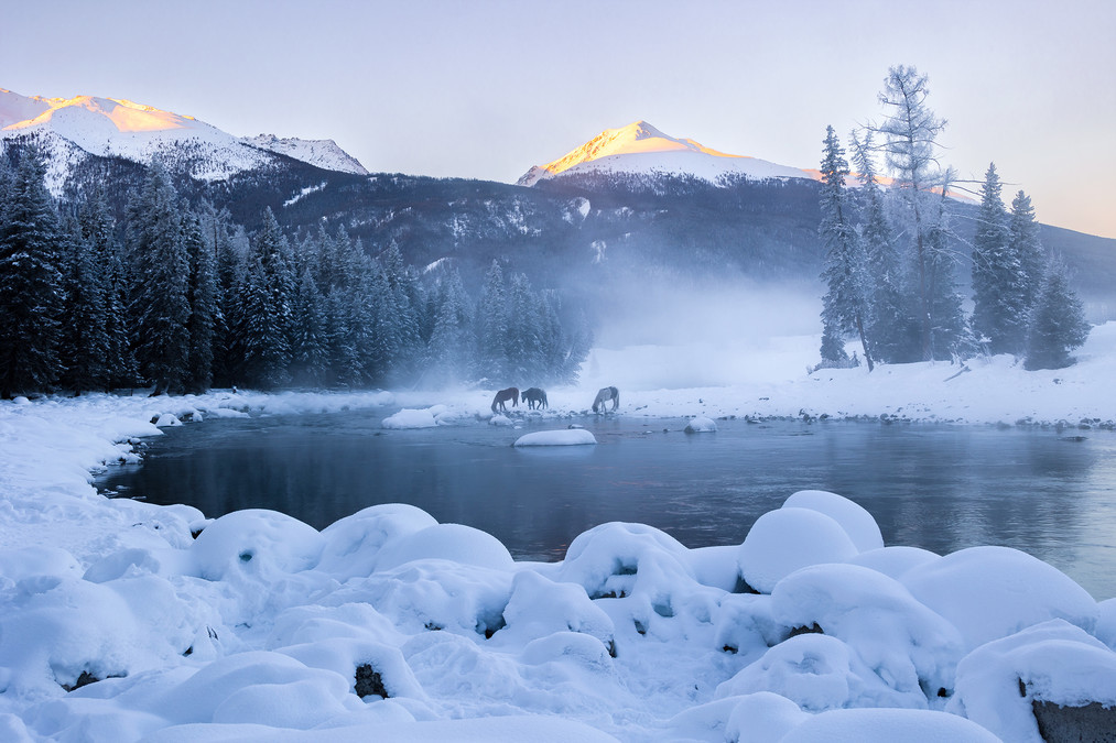
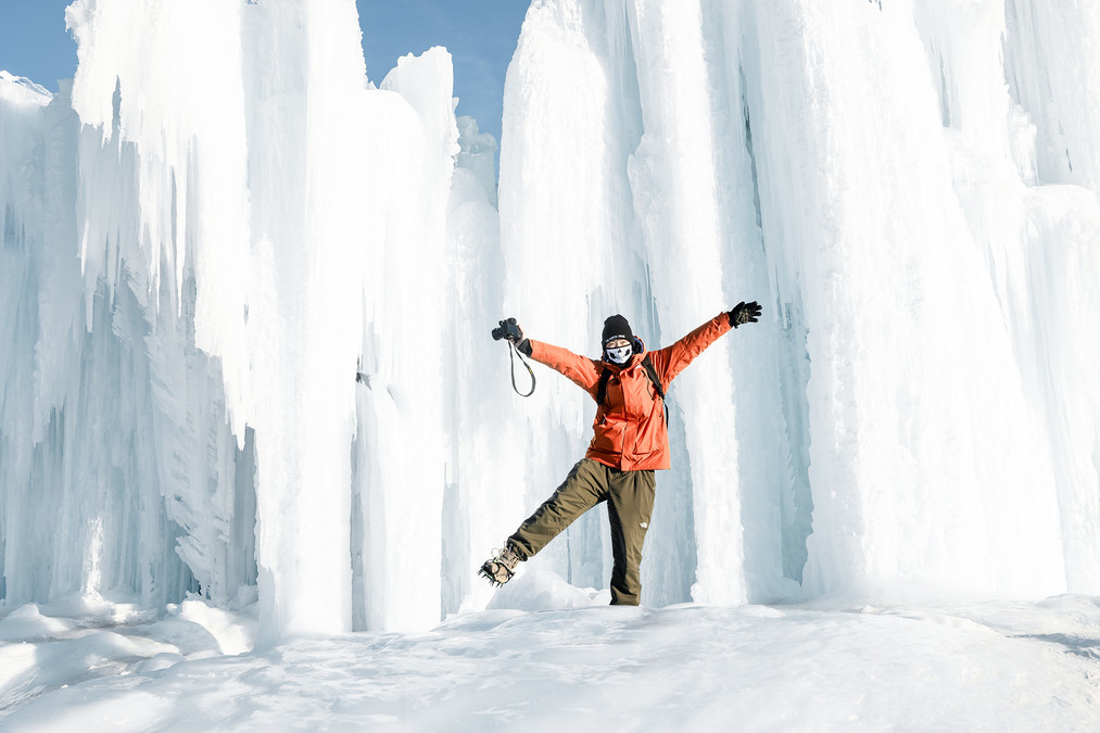
In the early morning of Shenshen Bay, there was an extremely cold yet breathtaking beauty. The temperature was minus 32 degrees Celsius, extremely cold and bone-chilling. After flying for a while, the drone showed that its battery power was running low, and it kept indicating that the battery temperature was too low. We hurriedly took a few photos and then made it return. Just a short while after it left, frost had accumulated on the small aircraft.
Walking among the mountain forest covered with frost flowers, it feels as if one has entered a painting in ink and color. The gentle breeze blows among the jade-like branches and snow-covered trees, and flakes of snow fall gracefully, making it so beautiful that it is truly captivating.
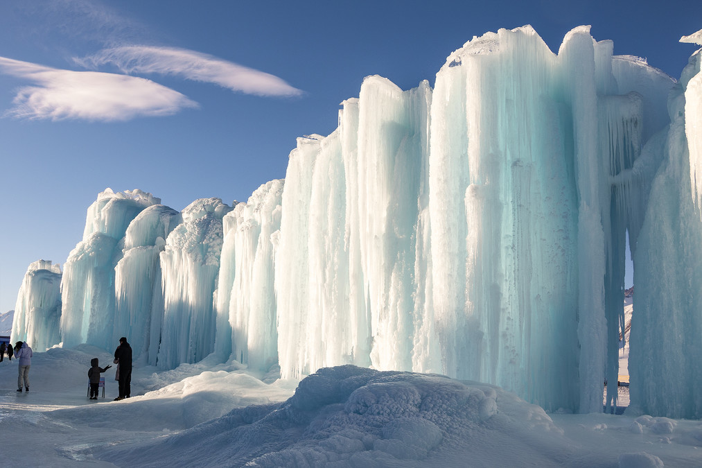
The snow crystals in Shenshen Bay are crystal clear and transparent, resembling a fairyland.
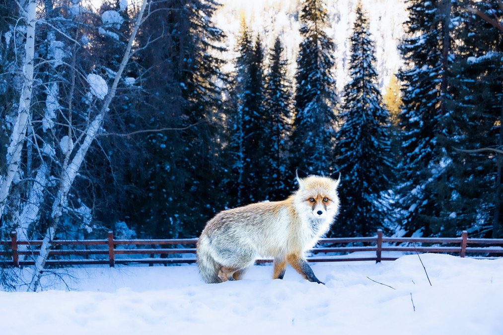
In Moon Bay, I came across a little fox that had come out to look for food. The little fox wasn't afraid of people, but it was rather timid. Whenever someone approached it, it would run away.
The Kanas scenic area in Altay region belongs to the cold temperate zone. The winter lasts for as long as seven months. The unique geographical environment causes the Kanas scenic area to receive its first snowfall from the end of September to the beginning of October. The precipitation is concentrated in the mountainous areas, while the plain areas receive less precipitation and have a large amount of evaporation. The annual average precipitation is 177.4 millimeters. The Kanas Lake is located in the Altay region of Xinjiang Uygur Autonomous Region, with an annual precipitation of around 1000 millimeters. The maximum precipitation zone is at an altitude of 2100 meters. The winter is long and the snowfall is abundant. Frost usually begins to appear in early August. Above an altitude of 1400 meters, snowfall begins in late August; above 3000 meters, snowfall begins in early August and continues until the end of May or early June the following year, with a snowfall period of up to eight months.
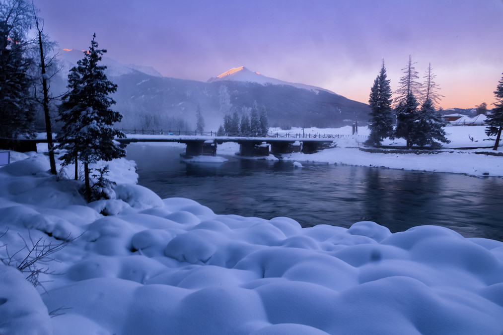
In the morning of the old bridge in Kanas, everything is peaceful and picturesque.
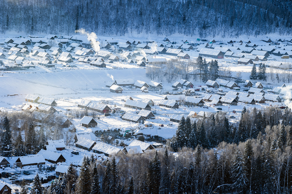
Watching the smoke rise slowly, encountering a fairy-tale-like winter - Hemed Village
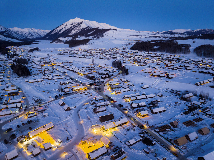
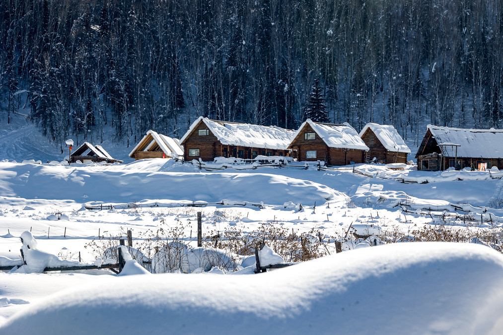
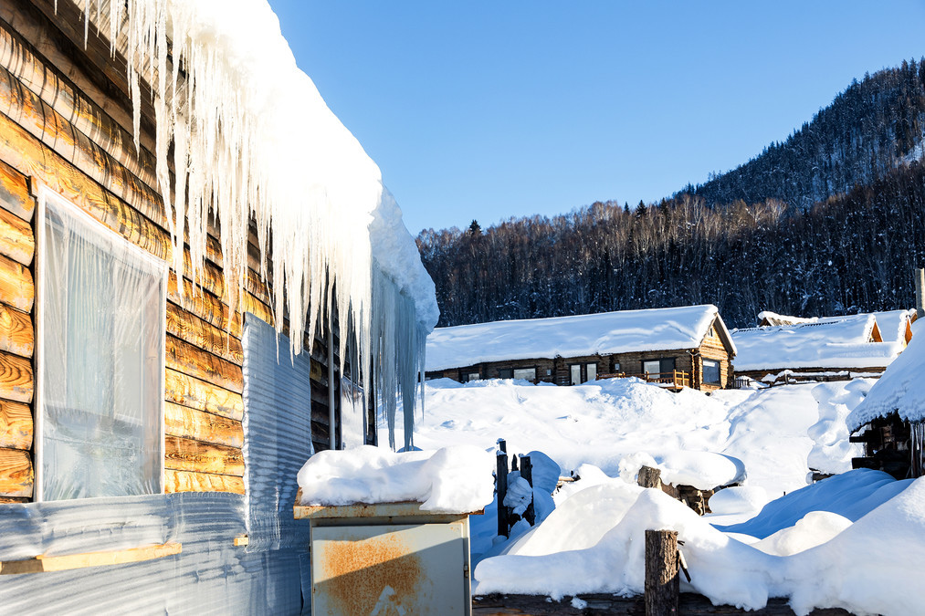
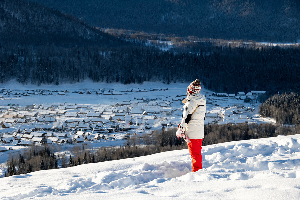
The winter scenery of Hemo Village in Xinjiang is breathtakingly beautiful. In the distance, the mountains are covered with a blanket of white snow, shining with a golden glow under the sunlight. At the foot of the mountains, there are a series of quaint wooden houses, with smoke rising from their roofs, mingling with the gentle snowflakes, slowly drifting away in the azure sky. The trees in the village are all dressed in a silver coat, and the icicles hanging on the branches are crystal clear, resembling scenes from a fairy tale world.
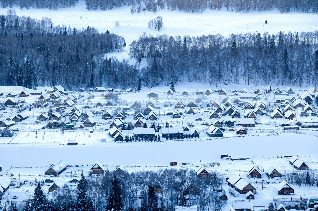
Hemo Village is a village under the jurisdiction of Hemo Kanas Mongolian Township in Bulijin County, Altay Prefecture, Xinjiang Uygur Autonomous Region. It is located in the north of Altay region, in the southwest of the middle section of the Altai Mountains, with the Kanas Nature Reserve to the northwest, the Friendship Peak to the north, the "Y"-shaped Hemo River to the south, Harapulen and Torogayit to the east, and the Kanas Kindingler and Mamankuus to the west. To the south, it is separated from the Hala Pulun by the Hemo River, and to the east, it is adjacent to the Altai Mountains. The north is close to the Russian border, with a straight distance of 55 kilometers, the west is close to the Kazakh border with a straight distance of 51 kilometers, and the east is close to the Mongolian border with a straight distance of 38 kilometers. It is about 70 kilometers away from Kanas Lake and 165 kilometers away from Bulijin County. The total area is 1,590 square kilometers.
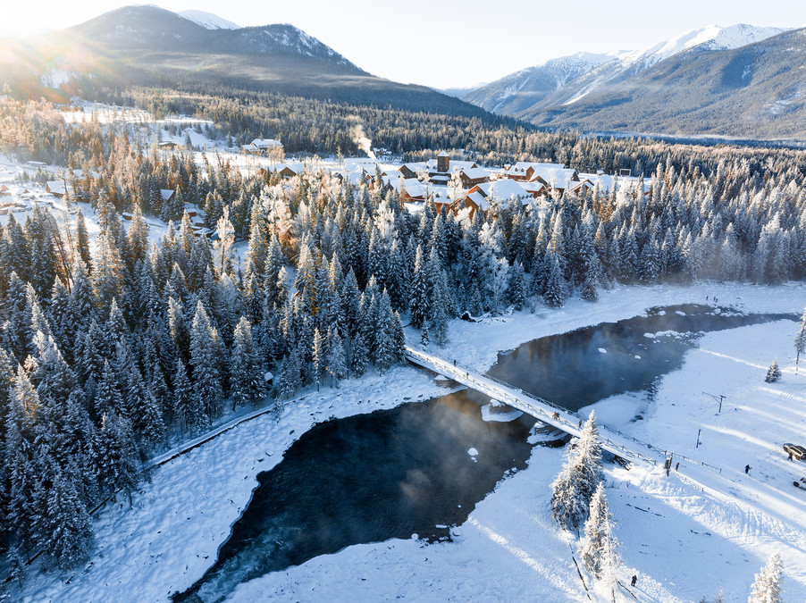
Hemo Village is located within the Kanas Scenic Area and is a settlement of the Mongolian Tuva people. It has the most intact and historically oldest Tuva tribe in China. It has the Jikpilin International Ski Resort, Hemo Bridge, and Haddun Observation Platform, among others.
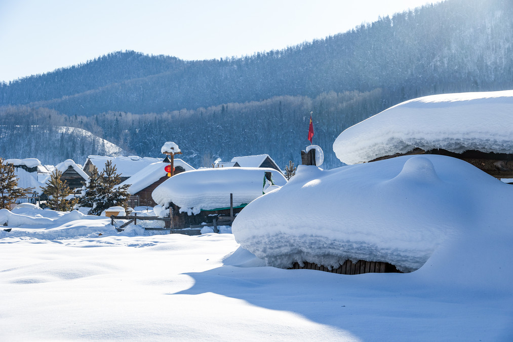
Hemo Village is located in the basin formed by the confluence of the Kanas River and the Hemo River. The altitude ranges from 1,124 to 2,300 meters. It has a hilly and mountainous terrain, sloping from north to south. The Hemo River runs through it. Hemo Village has a cold temperate high-altitude mountainous climate. The annual average temperature is -4℃ to 9℃. There is no distinct summer throughout the year, only the spring and autumn are connected, and the winter lasts for 7 months. The maximum snow thickness can reach 3 to 5 meters.
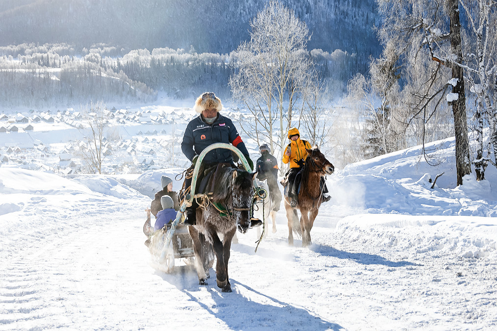
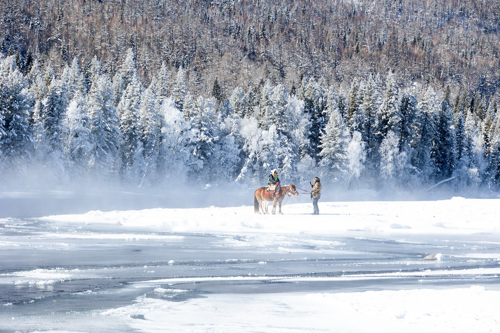
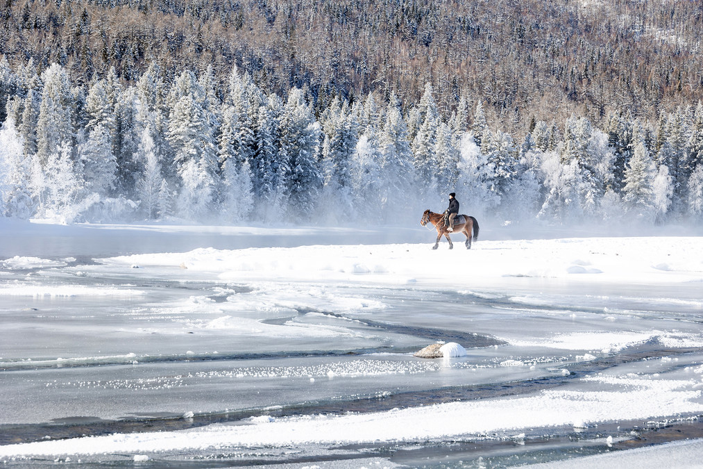
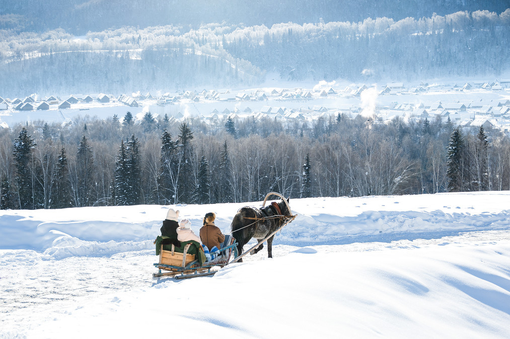
Early in the morning, we got on a horse-drawn sled and went to the Haddon viewing platform to capture the dawn scene of Hemo Village.
In the white birch forest of winter, the lush greenery and hustle and bustle of summer are gone, but there is an added touch of tranquility and mystery. Crystal-clear icicles hang from the tree trunks, as if they are carefully arranged decorations by nature. Each one shines with dazzling light. In the forest, occasionally a few bird chirps can be heard, clear and melodious, breaking the silence of winter and bringing joy to the heart. Here, you can take plenty of photos to commemorate the moment, and each photo will be a unique work of art.
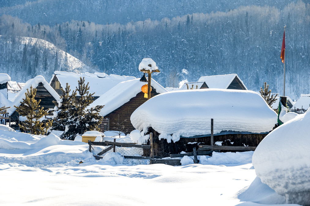
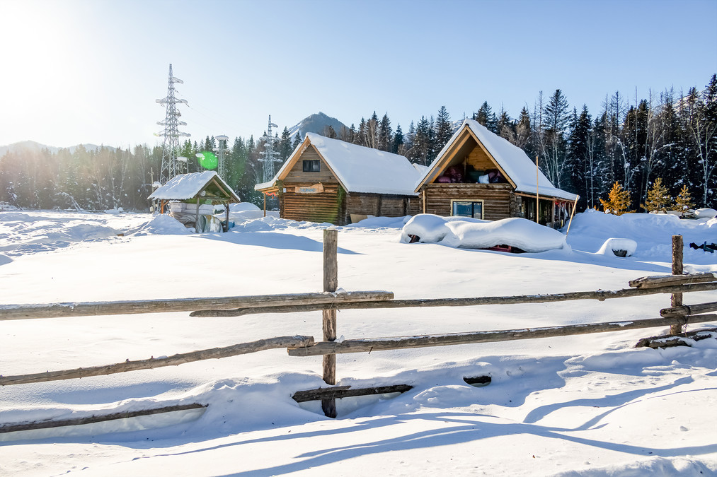
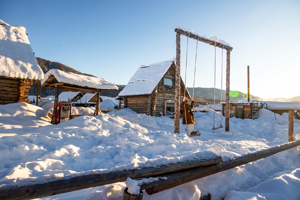
Entering the winter of Hemo Village, the first thing that catches your eye are the numerous and neatly arranged small wooden houses. These houses are covered with thick snow, only revealing the mottled roofs and windows, resembling the little houses in a fairy tale, serene and warm.
In the early morning, as the first ray of sunlight breaks through the mist and falls on the snow, the entire world seems to be illuminated. The golden sunlight and the white snowflakes complement each other, creating a series of breathtaking scenes that are truly delightful to behold.
In the winter of Hemo Village, time seems to move slowly and endlessly. Here, there is no hustle and bustle of the city, only the tranquility and beauty of nature.
Occasionally, one or two squirrels would leap down from the branches, leaving a series of small footprints on the snowy ground, adding a touch of vitality and energy to this silent winter.
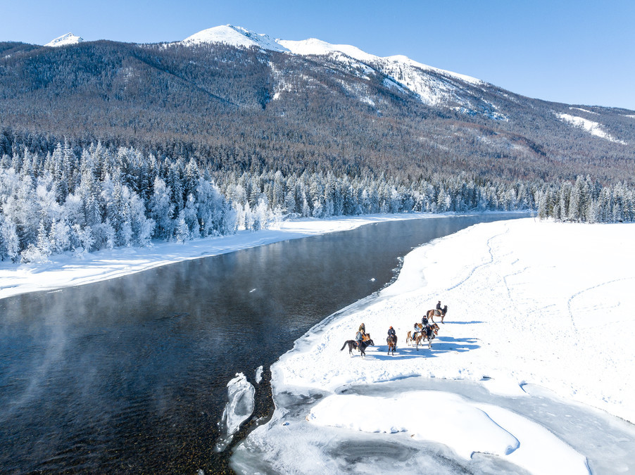
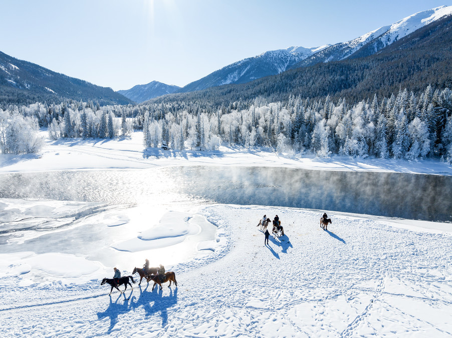
The northern part of Hemo is covered with ice all year round, thus forming glaciers. The Hemo River flows through the Hemo Village. The Hemo River is 68 kilometers long and is the second largest tributary of the Erguzi River. It originates from the snowmelt on the Friendship Peak (at an altitude of 4,374 meters) at the border between China and Mongolia, merges with the Kanas River, and then flows into the Bulintan River. The Bulintan River flows into the Erguzi River, which then passes through Kazakhstan and enters Russia, finally flowing into the Arctic Ocean.
On both sides of the path, there are carefully tended vegetable gardens and orchards by the villagers. Although it is now a desolate scene, under the cover of snow, it appears exceptionally serene and beautiful.
Walking along the narrow paths in the village, the snow beneath my feet made a "zing-zing" sound, which was the unique melody of winter.
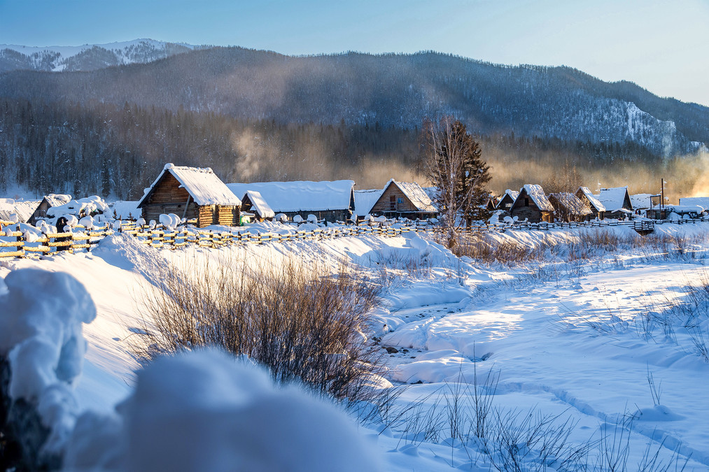
The villagers began their day's activities. Smoke rose gently from the chimneys, forming a harmonious and peaceful rural scene together with the distant snow-capped mountains and the nearby wooden houses.
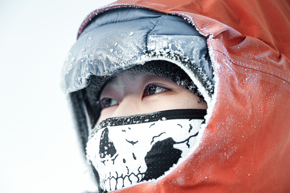
Here. The outdoor temperature was around minus 20 degrees Celsius. Standing outside would make you feel an intense cold. Without gloves, your fingers would lose sensation within a few minutes. We stood on the Haddon Observation Deck for a while, and the warm breath we exhaled turned into ice crystals. The eyelashes were covered with frost.
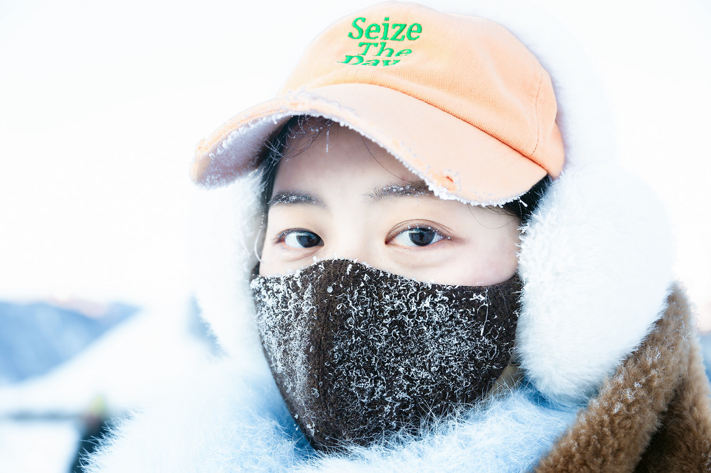
Yin Yin's face was covered with frost crystals.
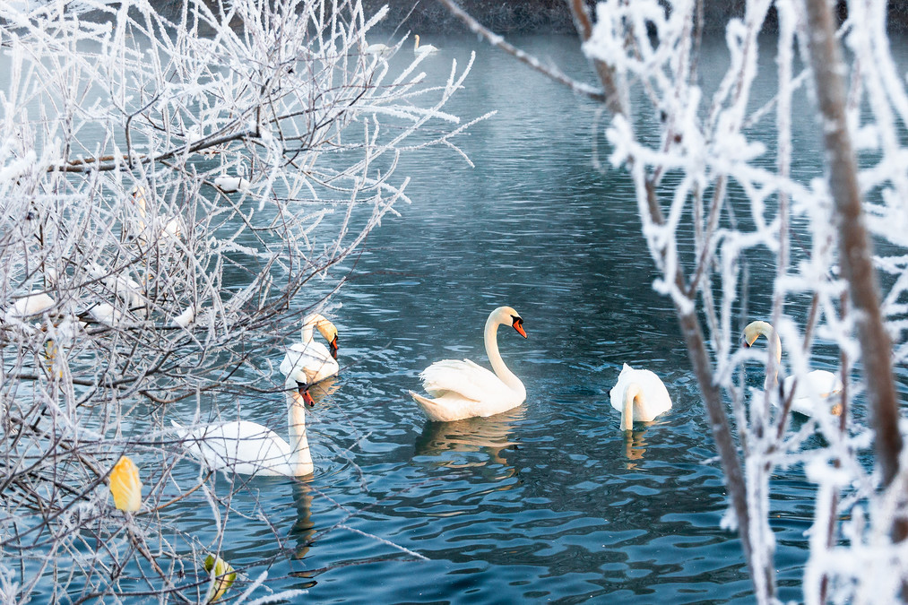
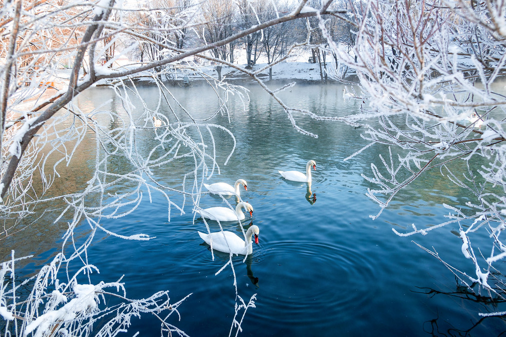
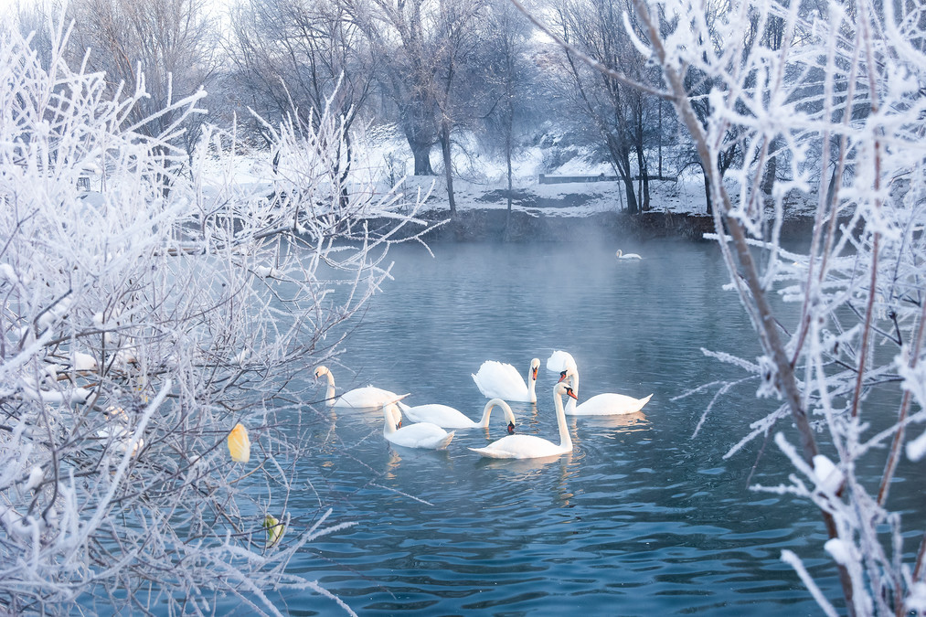
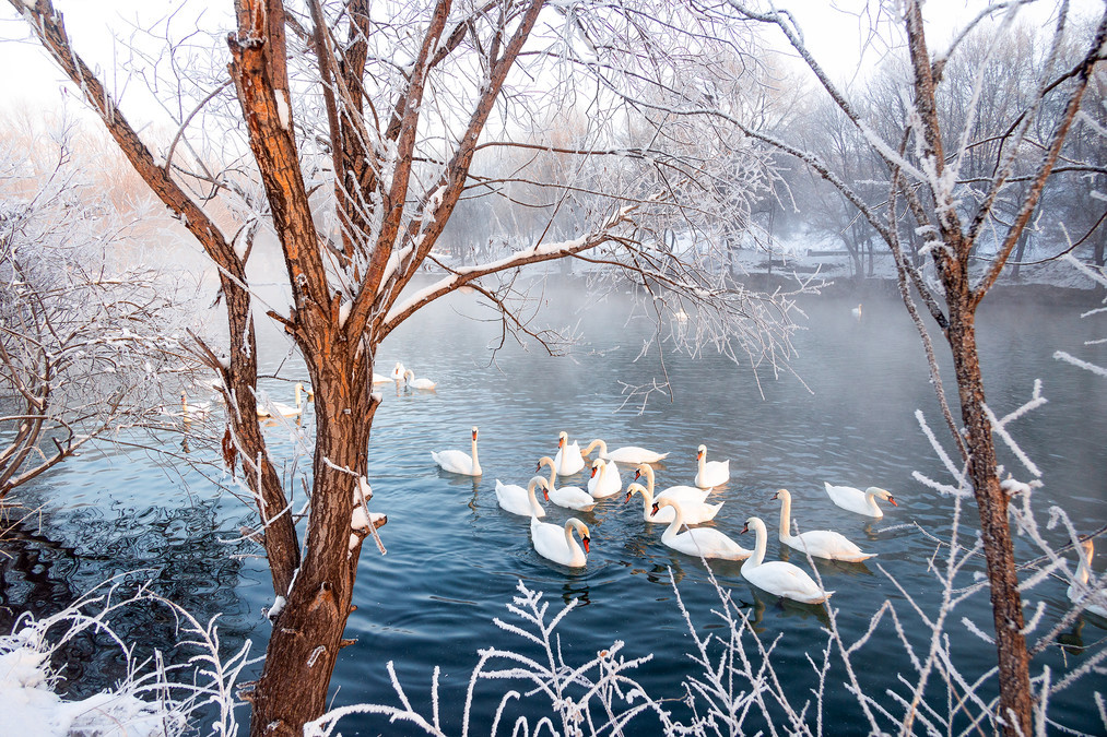
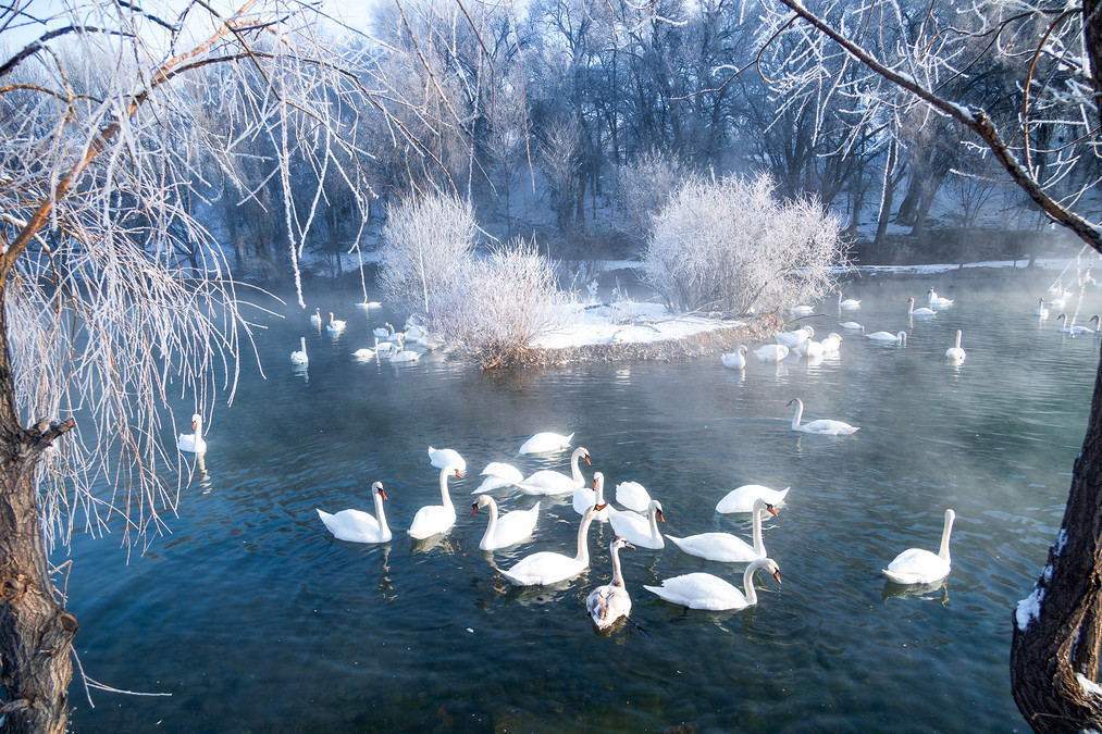
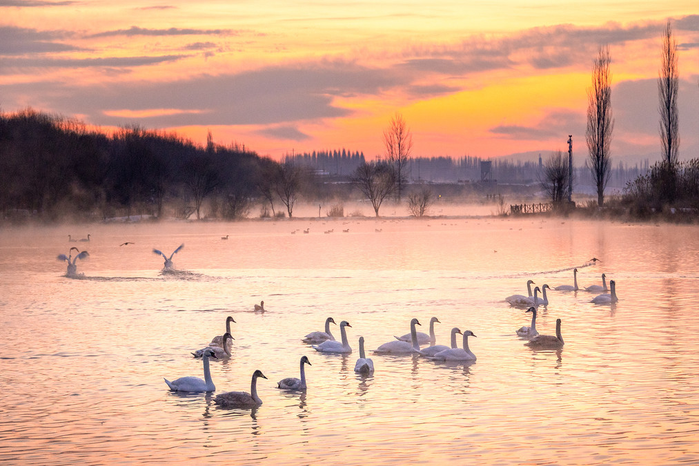
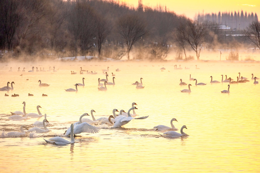
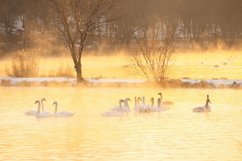
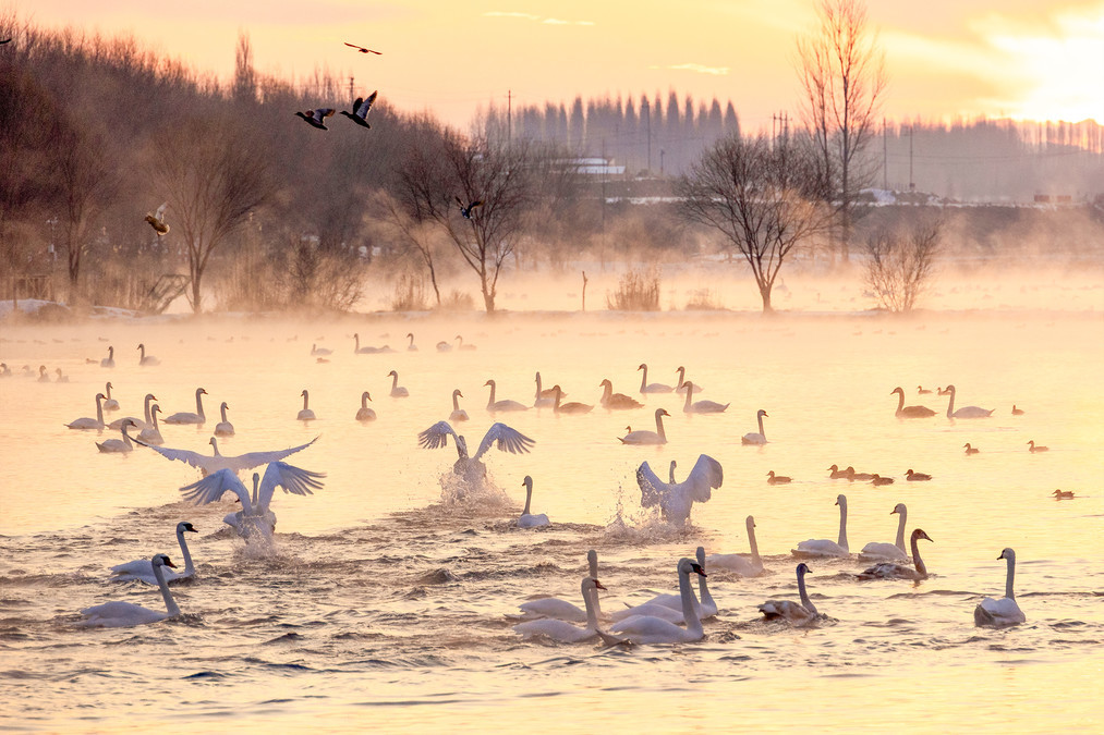
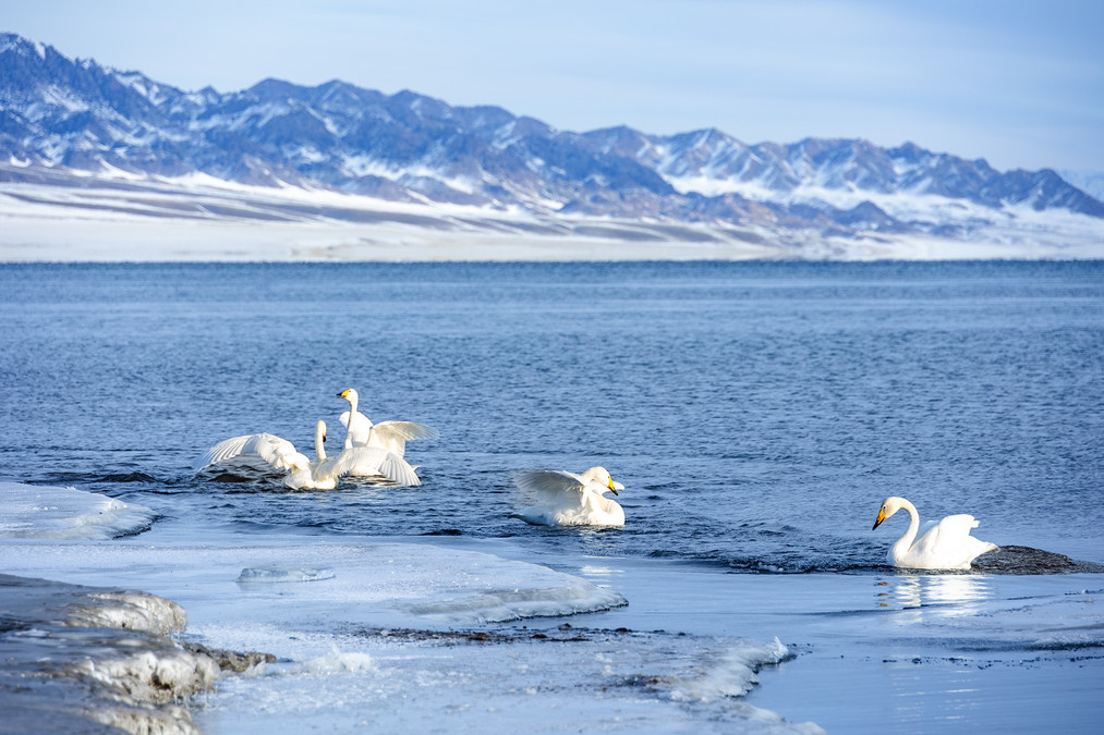
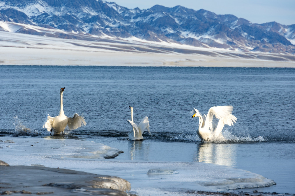
Swans dance to welcome the dawn - Yining Swan Spring
The Yining Swan Spring Wetland Park is located on the north bank of the Ili River, about 40 kilometers away from the city of Yining in the Yining County of the Xinjiang Uygur Autonomous Prefecture. It is situated in Xiaheleke Village, Yingtamu Township, Yining County. The park is about one hour's drive from Yining City.
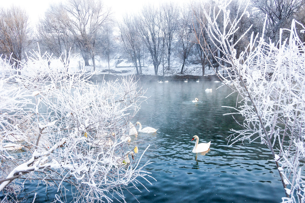
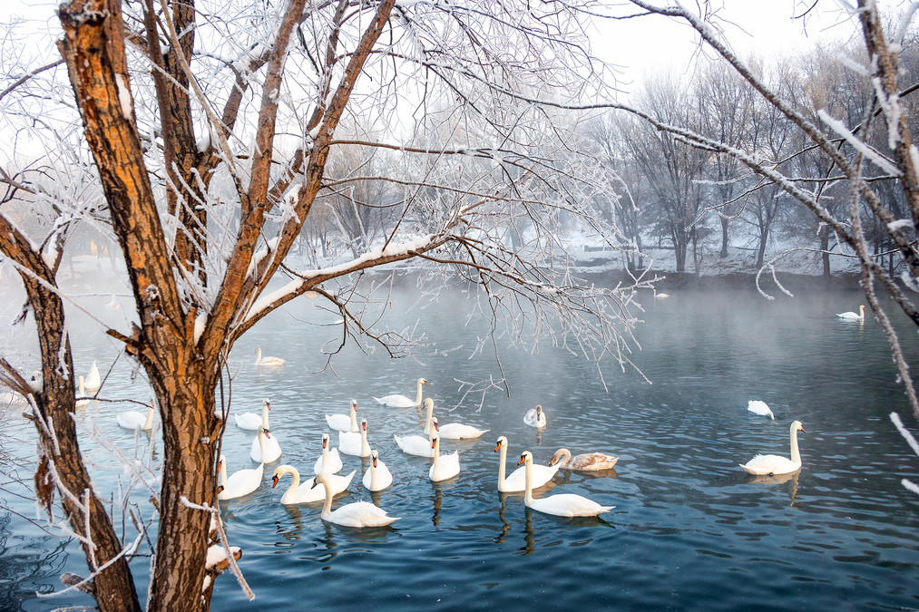
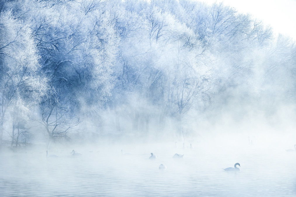
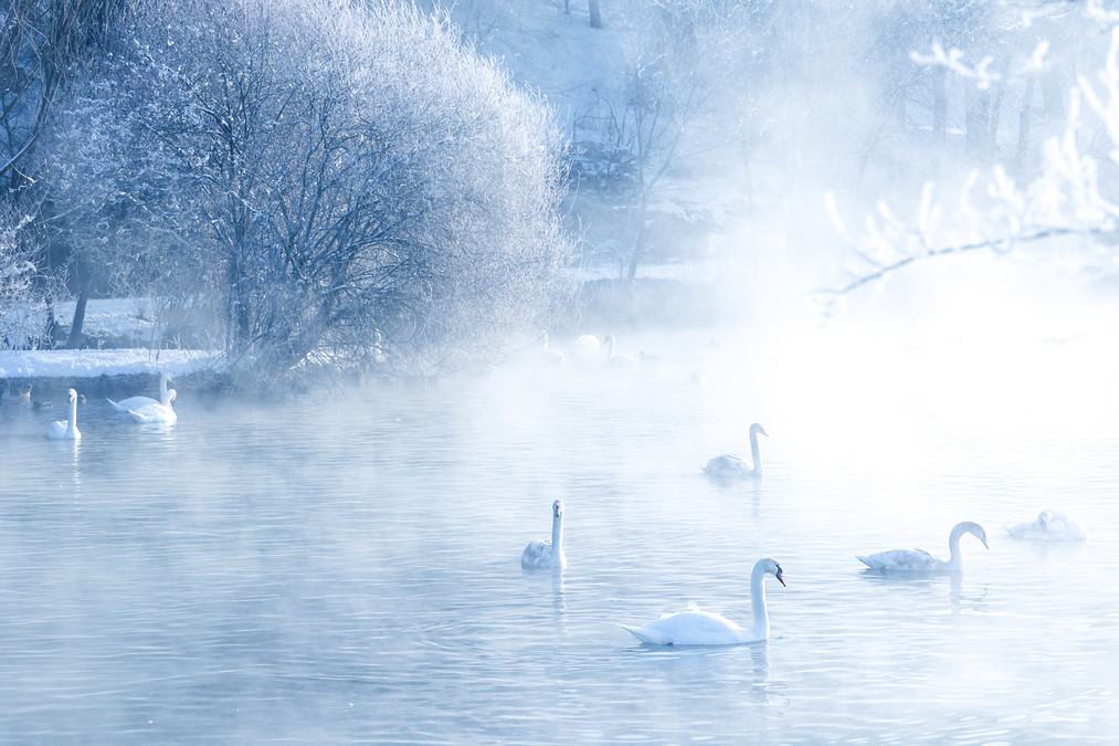
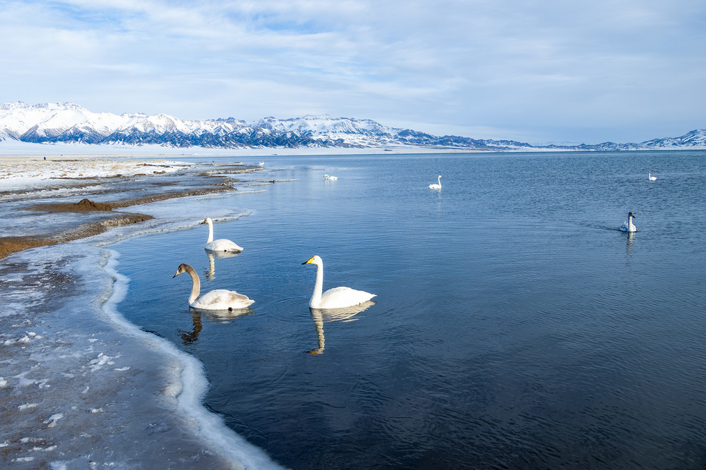
This is the only place in the Ili River Valley where swans do not freeze over during winter. Due to the effect of the underground hot spring water, the lake surface can maintain ripples and mist even in the coldest winter, resembling a fairyland. From October to the following April each year, groups of tufted-necked swans and large swans fly here to spend the winter. When the weather is good here, in the early morning, one can witness the spectacle of icicles, with the icicles dancing alongside the swans, which is truly breathtaking. Or at the blue hour in the evening, the remaining rays of the setting sun fall on the lake surface, and the entire scene is tinted with a dreamy blue, making it perfect for taking photos.
The swans at Yining Swan Spring mainly come from the Balkhash Lake in Kazakhstan and Russia. At the end of October each year, these swans fly over a thousand kilometers from the Balkhash Lake to the Yining Swan Spring Wetland Park to spend the winter. In early March of the following year, they fly back to the Balkhash Lake to lay eggs and hatch.
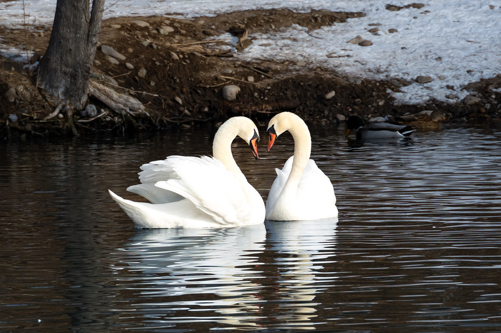
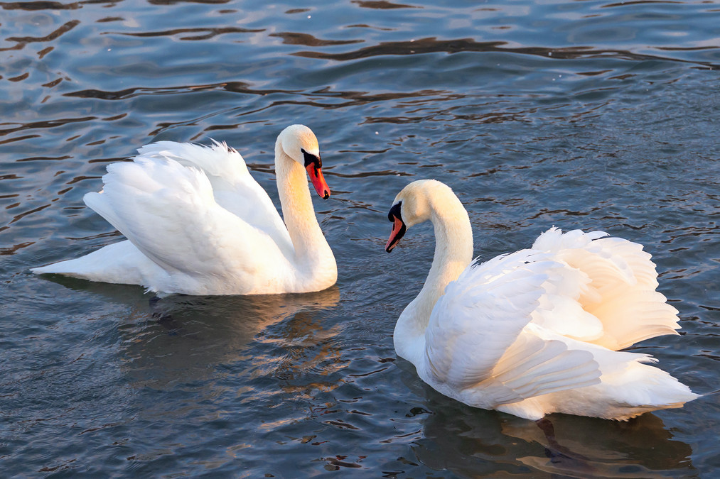
Xiahelek Village is located close to the Ili River. It is a village mainly inhabited by the Kazakh people. On the riverbank are numerous fish ponds. And the "Swan Lake", with an area of only 120 acres, is situated between the fish ponds and the houses. On both sides of the "lake" are the houses of the villagers. However, when winter arrives, the warty-necked swans abandon flying to the warmer southern regions and instead spend their time here playing and foraging, carefree.
According to the local villagers, originally there was no such small lake here. There were only several springs at the foot of the steep slope, which flowed continuously and formed a stream. In the 1980s, the villagers developed the aquaculture industry along the Ili River and built many fish ponds. Thus, this area of water was set aside near the springs to store the water and replenish the fish ponds. Over the past decade, lush aquatic plants have grown in the small lake, and the water temperature is relatively high. Even in the coldest seasons, the water does not freeze. All these have created favorable conditions for the wintering of the Pseudorhinoceros swans.
In 1993, Han Xinlin, a local villager engaged in aquaculture in this area, witnessed a pair of white swans and three gray baby swans mingling with his own domestic geese. Old Han did not drive away the "uninvited guests", but instead began to feed them together. Later, this family of swans returned every year, bringing more and more swans here. Because this underground hot spring does not freeze in winter, the swans could guard against the hunting of foxes and wolves, and the water plants also provided abundant natural food. Now, from early October each year to the following April, each year there are wattled swans (a second-class protected bird species) and large swans resting here.
The east gradually turns golden, and the sky unveils the beginning of the emerald blue; on the water's edge, the leafless branches are covered with frost, resembling a jade tree in a silver dress.
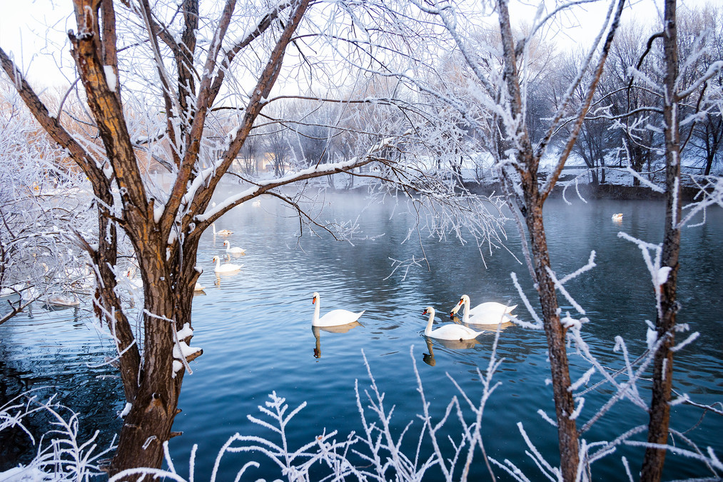
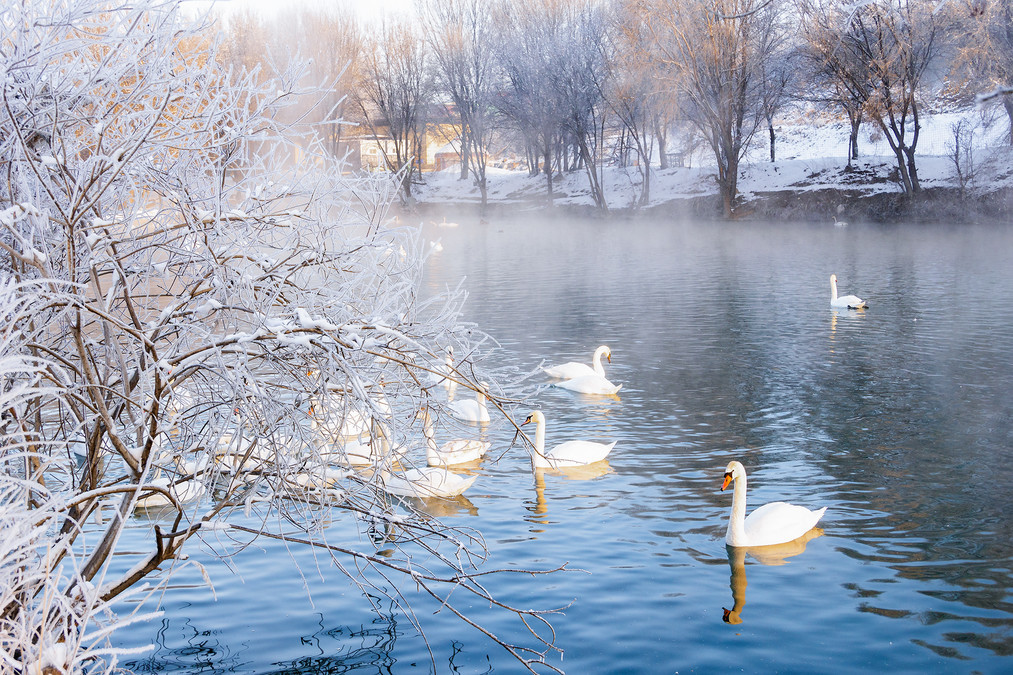
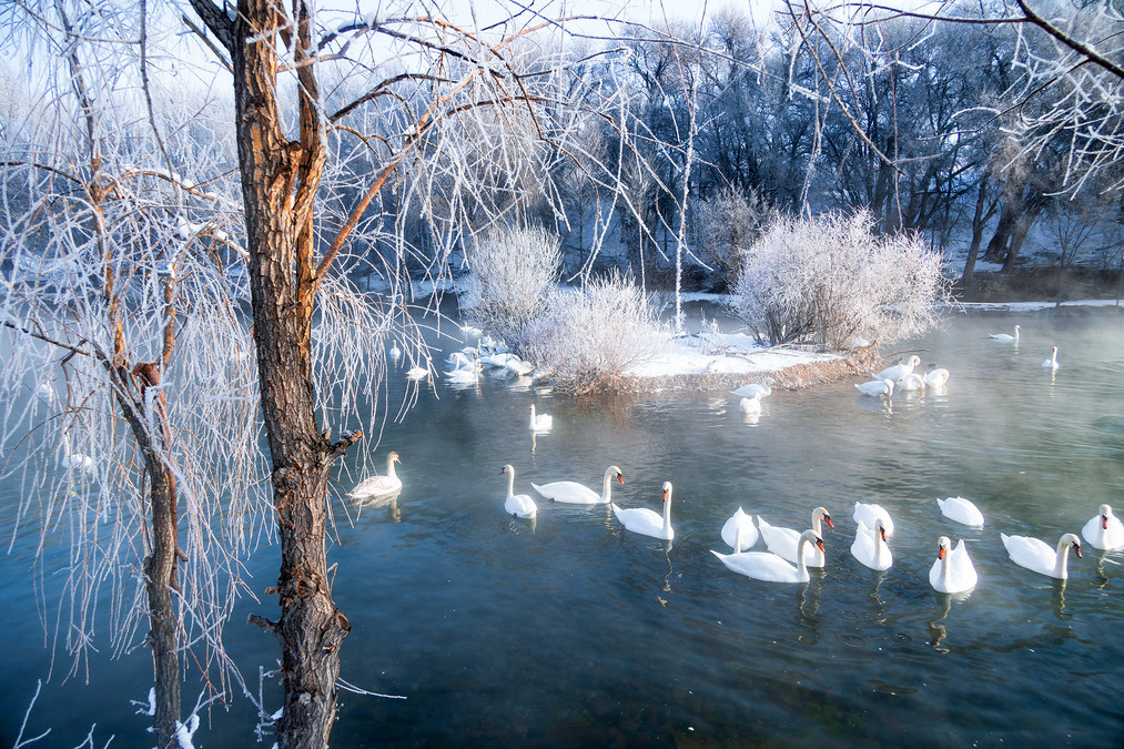
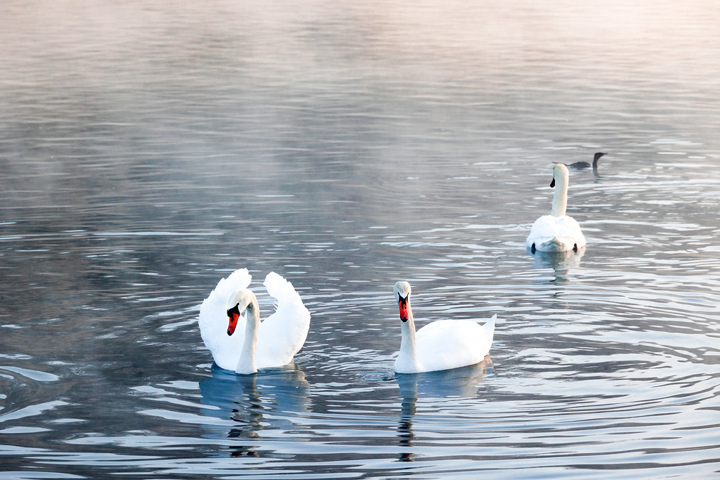
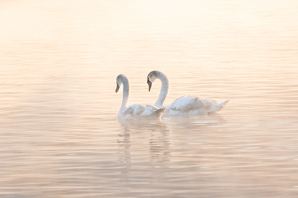
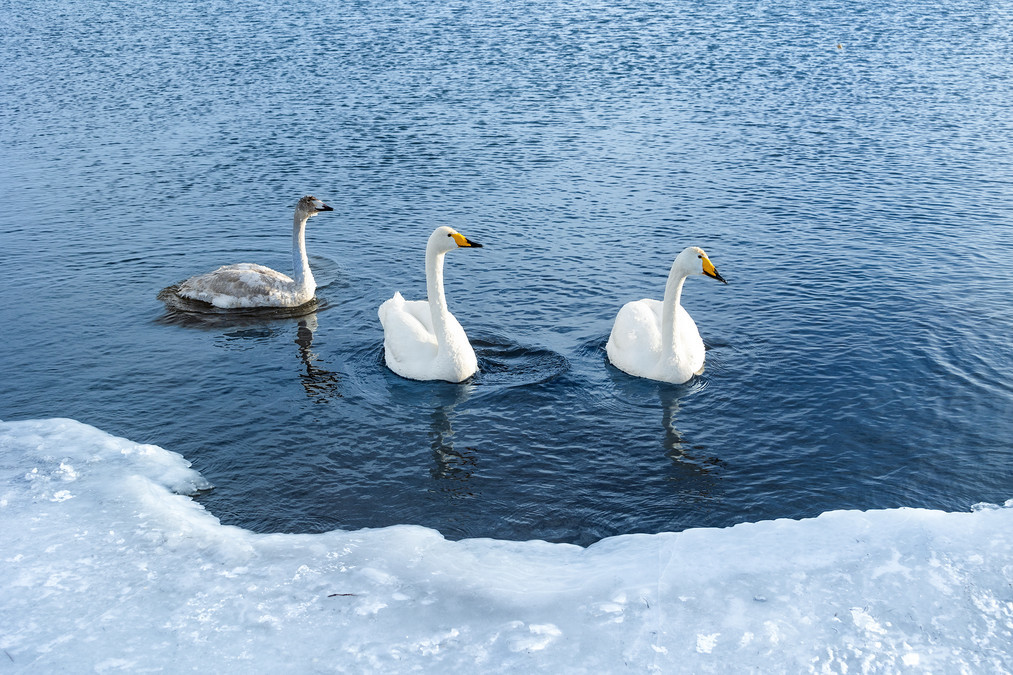
The clear and tranquil water surface rises with a gentle mist. The small trees and reeds along the lake are covered with frost. In the morning mist, the swans appear intermittently, whispering softly, lingeringly, gracefully. Sometimes they stroll gracefully in the water, and sometimes they dip their heads underwater to search for food.
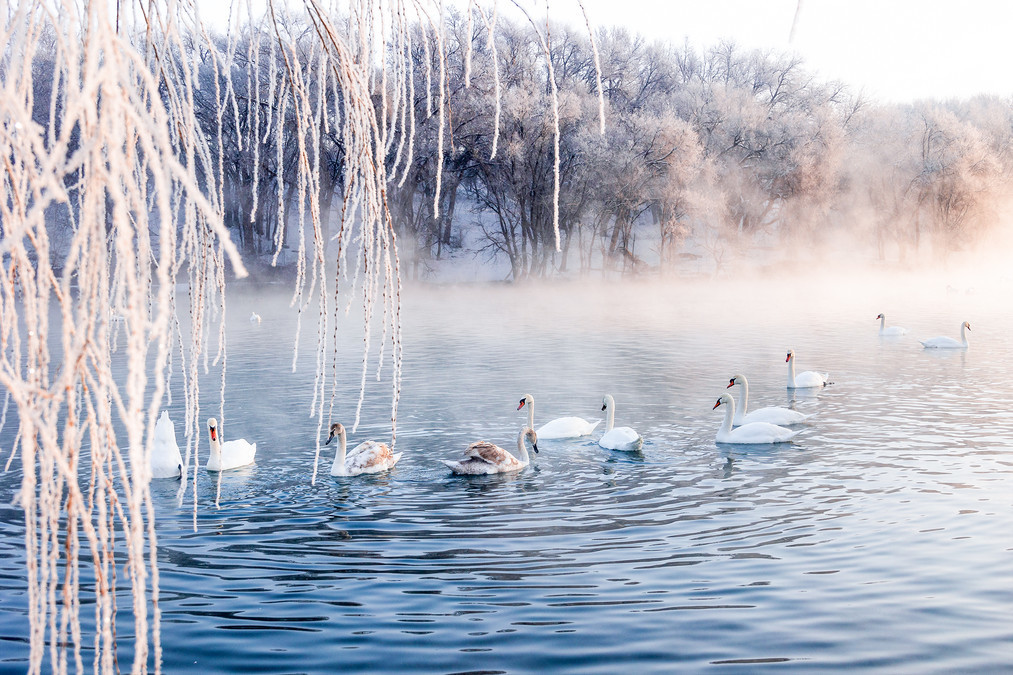
The mist rising from the water surface dances like a veil, gathering and dispersing at will. The swans, with their graceful postures, perform on the clear water as the stage, with the mist as the curtain and the frost flowers as the backdrop. They freely swim on the water surface. They move through the mist, appearing and disappearing intermittently, as if performing a mysterious and unpredictable dream play.
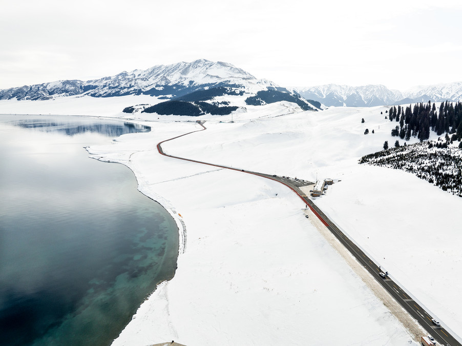
The exotic land from the west, the sacred soil beyond the world - Sayram Lake
The Salimüüy Lake is located in the Bolotar Mongolian Autonomous Prefecture of the Xinjiang Uygur Autonomous Region, in the city of Boluo. It was formerly known as "Pure Sea". The lake has an altitude of 2,071 meters. Its longest east-west dimension is 29.6 kilometers and its widest north-south dimension is 25.7 kilometers, covering an area of 458 square kilometers. The lake water is crystal clear and transparent to a depth of 12 meters. It is the highest-altitude and largest mountain lake in Xinjiang.
The altitude of the Salimüüy Lake is 2,073 meters, like a blue sapphire held by the mountains. The Mongolian people call it 'Seriümu Nuur', which means 'the lake on the ridge of the mountains'.
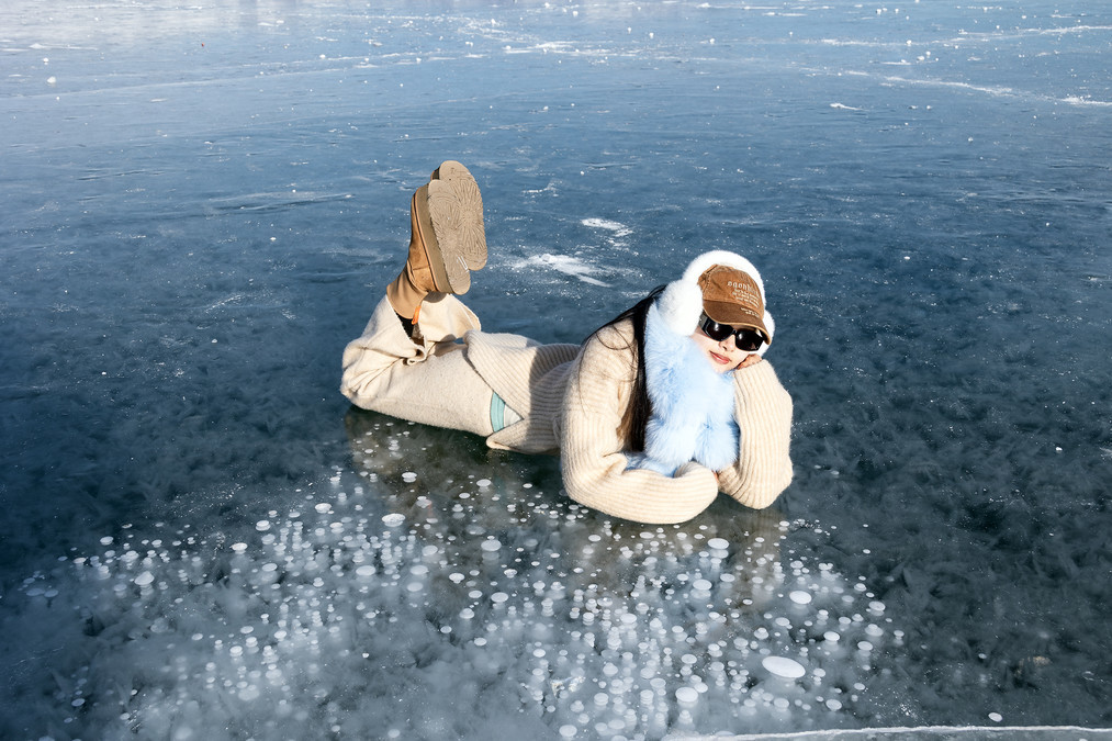
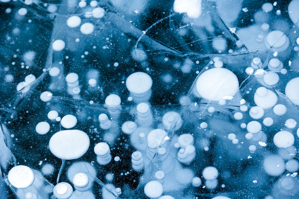
In winter, the lake surface freezes, and the lake ice contrasts beautifully with the snow on the distant mountains. The scenery is magnificent. When the cold wave comes, the lake surface will condense into blue ice. Sunlight passes through the ice layer and refracts deep blue light. There are countless bubbles sealed beneath the ice layer, layer upon layer, like constellations falling into the lake. The blue ice is like a painting, the ice bubbles are twinkling, like stars scattered. The vitality is abundant. Standing by the lake, the cold wind is piercing, but it cannot dispel the shock in the hearts of the tourists. Between heaven and earth, it seems that only this blue ice remains, pure, ethereal, and mysterious. One cannot help but hold their breath, fearing to disturb this dreamlike sacred place.
The winter of the Salimüüy Lake is not only a serene picture but also a touching poem. Here, the blue ice tells the story of time, the bubbles record the change of seasons, and the tourists' laughter and joy add vitality and energy to this snowy world.
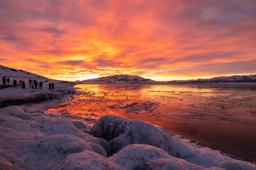
In winter, the Sayram Lake looks like a fairyland from a fairy tale, serene and beautiful. The ice-covered lake surface is crystal clear, reflecting the blue sky and white clouds, as if it were a delicate ink painting. At sunrise, golden light spreads over the lake, looking dreamlike and enchanting; at sunset, the lake surface seems to be coated with a layer of gold foil, remaining quiet and profound.
In winter, the Sayram Lake is surrounded by deep blue water and snow-capped mountains. Especially after a snowfall, when you look around, it's like half blue and half white. Staring at this blue and white world for a long time, it feels as if you are at the end of the world. Your thoughts can freely roam here. Everything is so beautiful.
The thawing process began in March of the following year, with phenomena such as ice melting and ice pushing occurring. The picture above shows ice pushing. It is very spectacular when the temperature is extremely low in the morning.
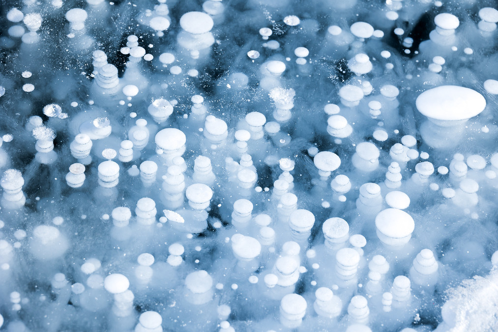
During the freezing process, the methane produced by anaerobic microorganisms decomposing beneath the ice layer forms string-like ice bubbles, which interweave with the ice flowers formed by the condensation of water vapor in the air, creating a fantastical world beneath the ice.
In this blue and white world, there are also beautiful swans swimming in the lake. They are like the spirits in this icy world, seamlessly blending with this blue and white landscape, presenting a beautiful and romantic scene.
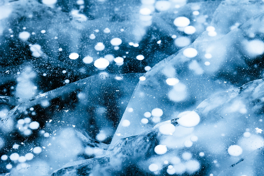
Inside the ice layer, numerous bubbles rise vertically from the bottom of the lake. They take on various shapes within the transparent lake ice and are extremely beautiful. These bubbles are formed by gases such as methane released from decaying plants at the bottom of the lake. As they rush towards the surface, they are rapidly frozen to form.
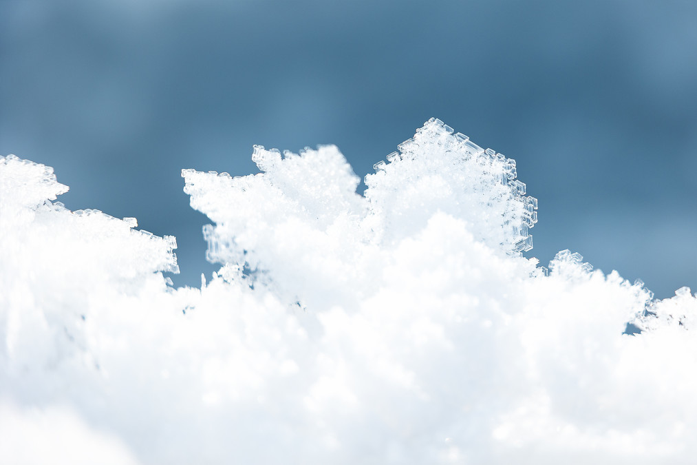
The formation of ice flowers in Sayram Lake is mainly due to the sudden drop in temperature and the freezing of overly cold saturated water vapor on the ice surface. When the temperature drops sharply within a short period of time, the overly cold saturated water vapor collides with the clean and smooth ice surface, and the water vapor gradually "grows" into ice flowers on the ice. These ice flowers are crystal clear and extremely magnificent. Standing by the lake, it feels like stepping into a dream world.
The formation process of ice bubbles in Sayram Lake mainly consists of the following key steps:
Organic matter decomposition produces methane gas: The bottom of Sayram Lake is rich in organic matter. Under the action of microorganisms, these organic matters decompose and produce methane gas. These gases provide "seeds" for the formation of ice bubbles. Rapid cooling freezes the bubbles: When the lake surface temperature drops rapidly, the ice layer on the lake surface will form quickly. The methane gas is quickly frozen by the rapidly forming ice layer, thus forming ice-below bubbles. Calm lake surface is conducive to bubble ascent: Only when the lake surface is calm can the methane gas rise smoothly, and the bubbles can grow steadily.
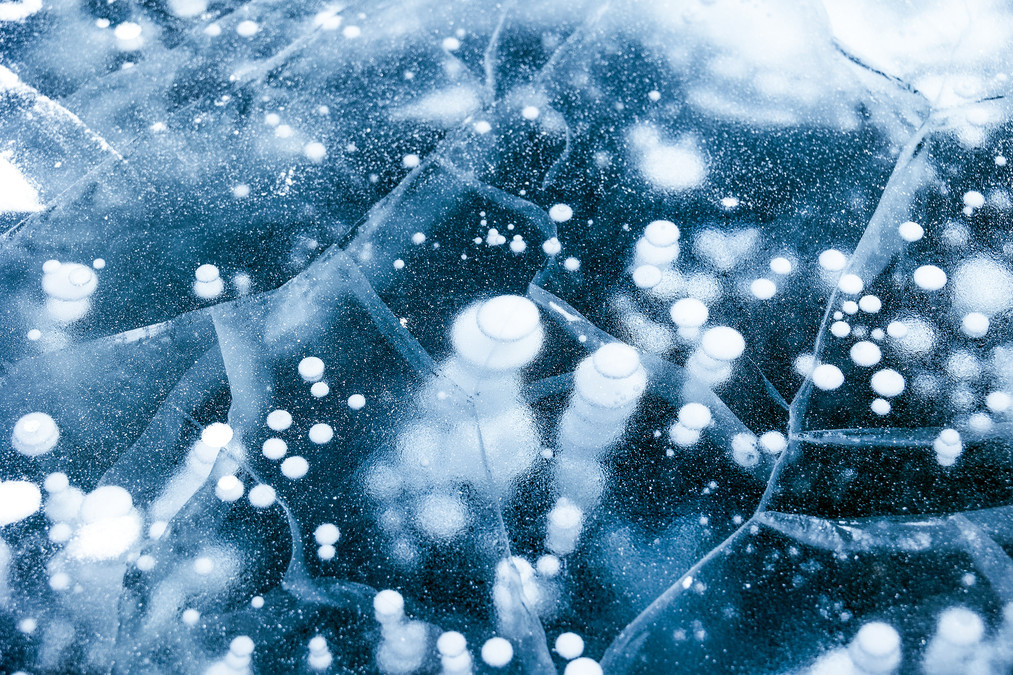
Water pressure changes cause bubble expansion: As water depth decreases, water pressure drops, and the volume of the bubbles gradually expands. When the bubbles reach beneath the ice layer, their volume will further increase, sometimes reaching diameters over half a meter.
The rate of temperature drop affects bubble freezing: The rate of temperature drop must be fast enough so that the lake surface and different water layers near the surface can freeze successively and rapidly within a short period of time. Thus, during the ascent of methane bubbles, when they are about to reach the ice layer, due to the continuous and rapid drop in temperature, the bubbles that have just reached the upper layer of the water body are "sealed" within the ice layer as the water layer continues to freeze.
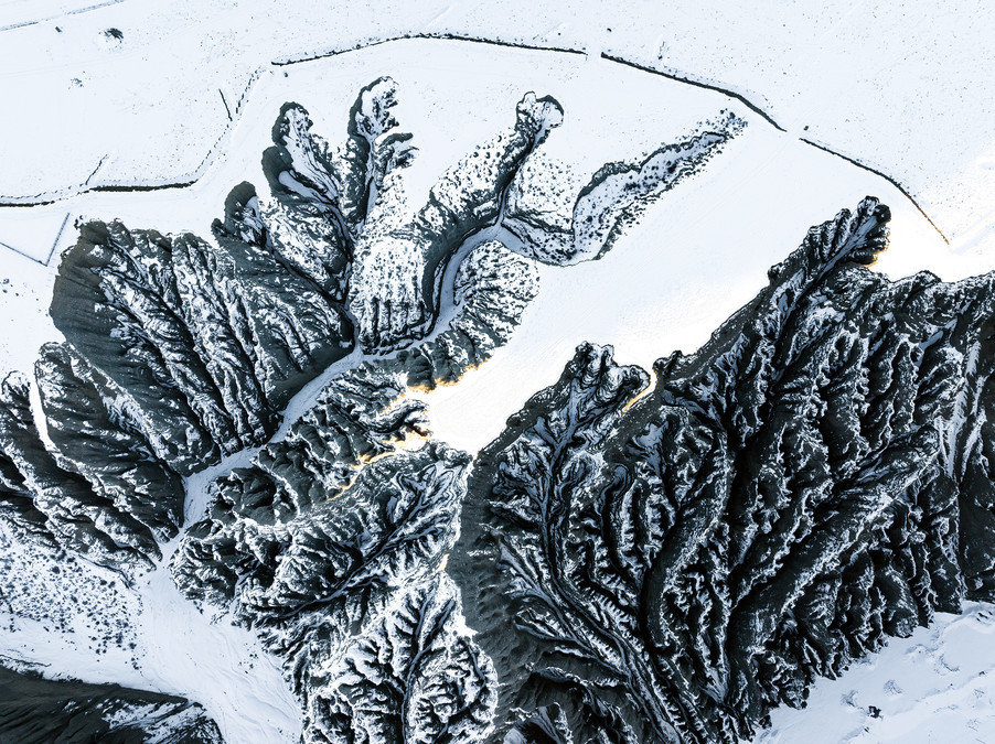
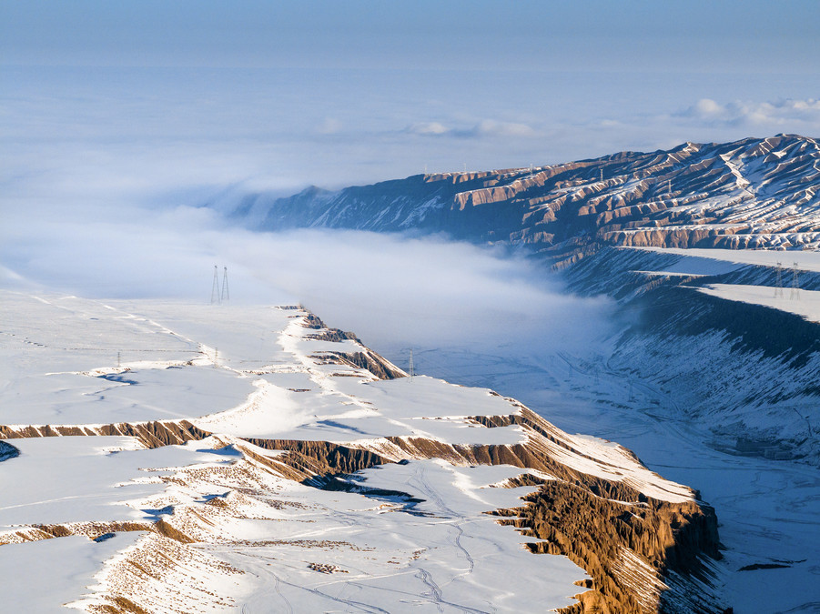
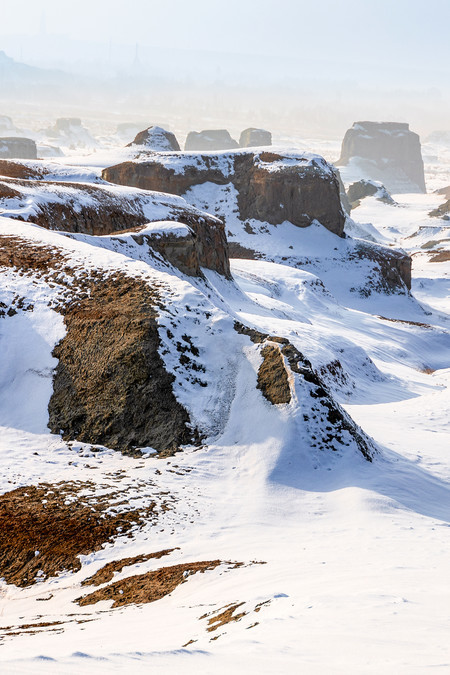
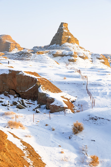
Crossing Hundreds of Millions of Years of Time — Dushanzi Grand Canyon & World's Devil City
Dushanzi Grand Canyon is located in Dushanzi District, Karamay City, Xinjiang. It is a natural landscape area dominated by Danxia landform. The bottom of the canyon is about 100-400 meters wide, the shoulder is 800-1000 meters wide, and the height from the bottom to the shoulder can reach 200 meters, with an altitude of 1070 meters. It belongs to a typical canyon landscape. It is located at the northern foot of the Tianshan Mountains, with a perilous terrain and beautiful scenery. The formation of the canyon is due to the river cutting the sloping plain in the southwest of Dushanzi after flowing out of the Tianshan Mountains, creating a magical landscape canyon. The terraces on both sides of the canyon are clearly visible, with at least nine levels. The terraces are covered with desert grassland, with plants such as Artemisia and Stipa growing on them, forming a sharp contrast with the steep canyon walls, creating a magnificent natural picture. The bottom of Dushanzi Grand Canyon is 100-400 meters wide, the shoulder is 800-1000 meters wide, and the height from the bottom to the shoulder can reach 200 meters, with an altitude of 1070 meters. The landform here belongs to the canyon landscape, with steep canyon walls and cliffs, and the water flowing in the canyon sometimes splits and sometimes merges, showcasing the supernatural craftsmanship of nature.
Dushanzi Grand Canyon is known as "Secret Realm of Dukou, Wonder of a Billion Years", and is a brilliant pearl on the northern slope of the Tianshan Mountains in Xinjiang. This canyon was formed by the billions of years of erosion by the snow water of the Tianshan Mountains. Its magnificent scenery has been featured on the cover of National Geographic magazine and is the first breathtaking scenic spot on the Dukou Road.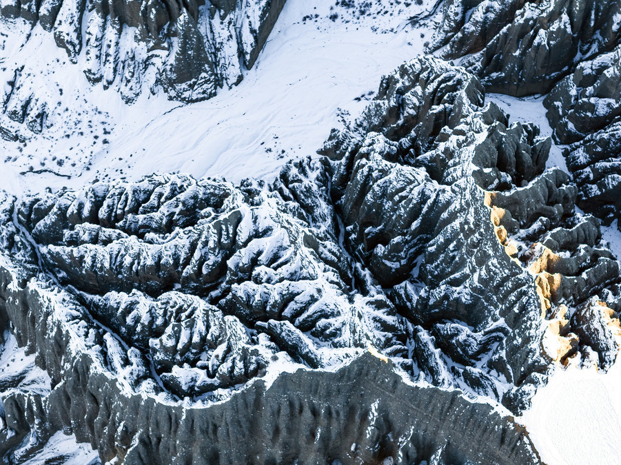
In winter, snowflakes fall in Dushanbei Grand Canyon, covering the entire canyon in a white blanket, transforming it into a fairy-tale world. At this time, the canyon appears even more serene, mysterious and romantic.
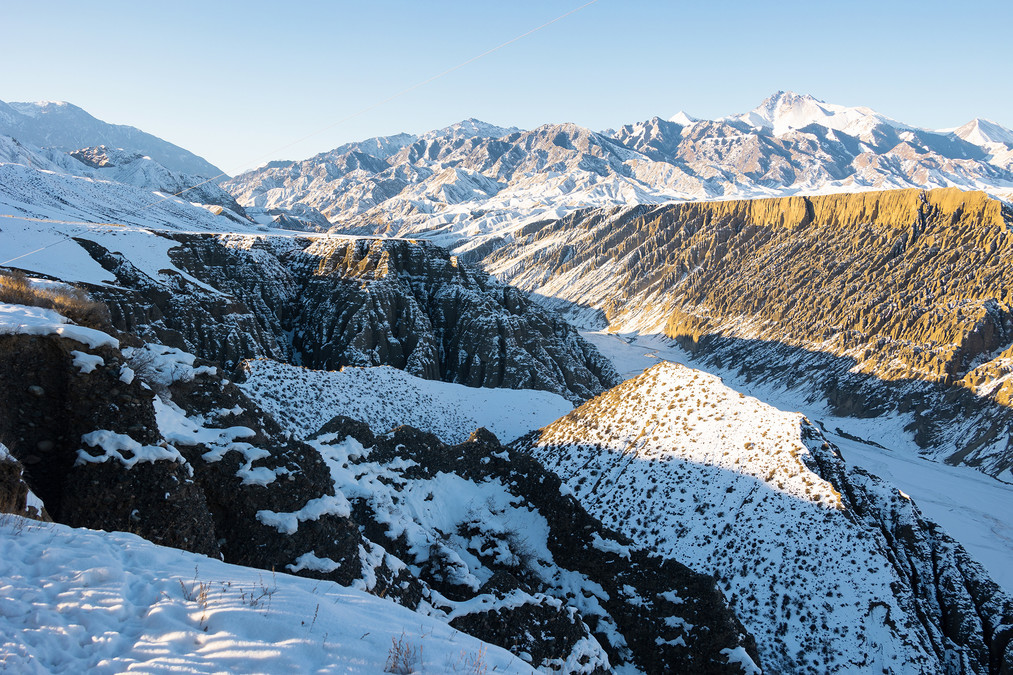
The formation process of Dushanzi Grand Canyon is mainly due to the long-term erosion and erosion caused by snowmelt and rainwater from the Tianshan Mountains. Specifically, Dushanzi Grand Canyon was formed by the continuous downcutting of the Kuitun River on the surface of the earth. The snowmelt of the Tianshan Mountains merged into the Kuitun River, which cut through the inclined plain in the southwest of Dushanzi, creating this magnificent canyon landscape.
This is the filming location for the movies "Speeding Life", the TV series "Return Road", "Jiu Zhou Piao Miao Lu", the variety shows "Onward Growth", "Goodbye, My Love", and "Food Across Eight Thousand Miles", among others.
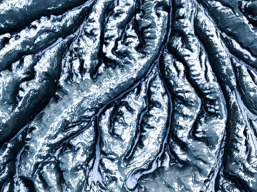
The rocks within the canyon have a rich variety of textures. Some of the rocks resemble solemn Buddha statues, while others resemble eagles spreading their wings, each with its own unique form and lifelike appearance.
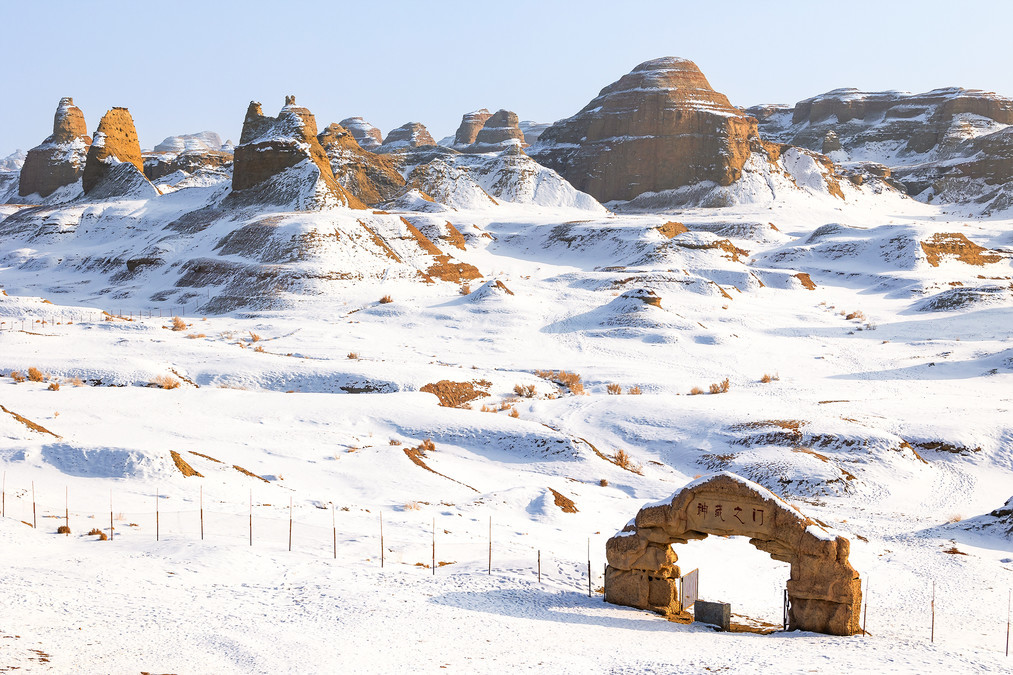
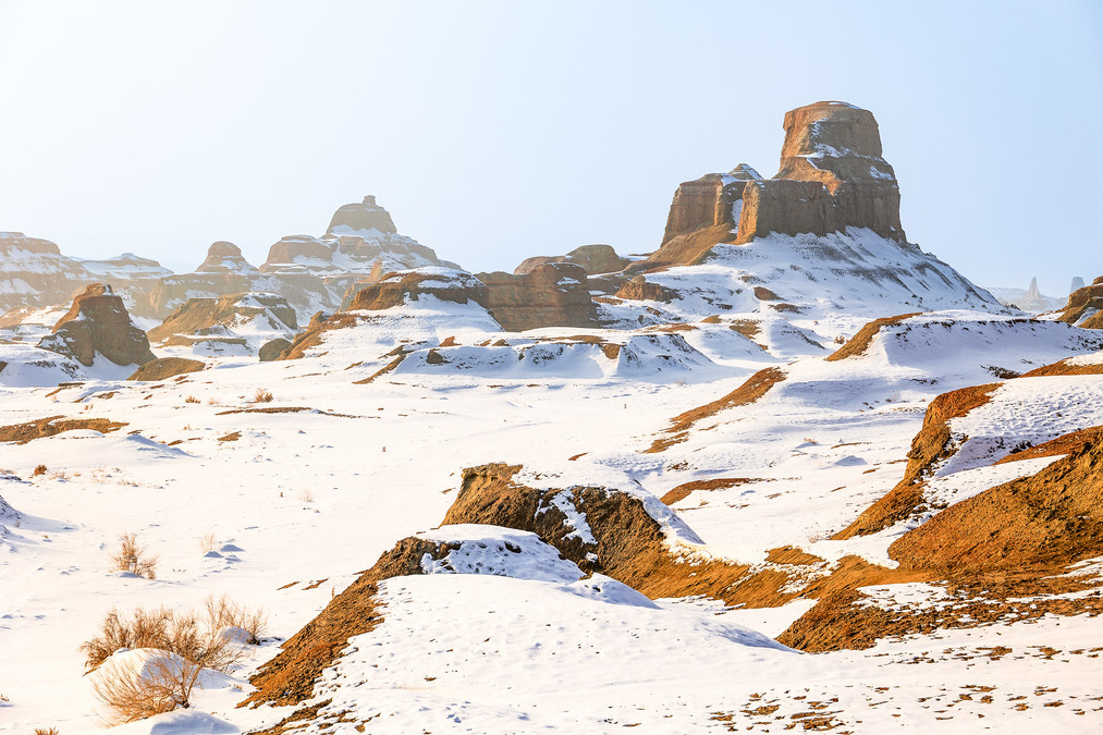
The World Devil City Scenic Area in Karamay City, abbreviated as World Devil City Scenic Area, is a geopark for viewing the Yadao landform landscape located in Karamay City, Xinjiang Uygur Autonomous Region. The total area is 260 square kilometers, and the core area of the Yadao landform is 22 square kilometers. It is oriented in a northwest-southeast direction, and the scenic area combines the Gobi and Yadao landforms.
In the Cretaceous period, approximately 100 million years ago, the World Devil City Scenic Area of Karamay was a vast freshwater lake. Plants grew on the lake surface, and various ancient creatures such as Urumqi Stegosaurus, Chasmosaurus and other prehistoric animals lived and reproduced in the water. Later, due to two major geological movements, the lake turned into a vast land sea composed of sandstone and mudstone. Geologically, it is called the "Gobi Platform".
Whenever a fierce wind blows, strange roars can be heard here, so it is called the Devil's City. The World Devil's City is located in a windy area, with the maximum wind force reaching 10-12 levels. It is one of the important "must-visit spots" on the northern Xinjiang tourism route.
The geological formation of the Devil City began with the Himalayan orogeny. This movement caused some red strata to tilt and undergo gentle folding, and raised the red basin, forming an outflow area. Water flowed towards the low-lying area in the center of the basin and eroded along the vertical joints of the rock strata, forming deep gullies with vertical walls, known as alley valleys. The debris at the foot of the cliff of the alley valley, when not all removed by the water, forms a slope with a gentler gradient, known as a debris cone. As the cliff walls collapse and retreat, the debris cone keeps growing upwards, covering a wider area of the bedrock surface, and the lower part of the debris cone forms a gentle slope in the same direction as the inclination of the debris cone. The retreat of the cliff face collapse causes the summit area to gradually shrink, forming boulder-like residual peaks, stone walls or stone pillars, and other landforms. The Devil City is a "wind erosion city" because it is caused by the air flow, and it is a wind erosion landform. The wind sweeps up sand and stones, constantly hitting, colliding and rubbing against the rocks, thus producing various sounds. Over time, various rocks of different hardness accumulated and were blown into various strange shapes by the wind.
The strata of the World Devil City were formed by the accumulation and overlapping of sedimentary rocks from the Paleozoic era. Therefore, the density of the rocks varies, and their thickness also differs. Moreover, it is located in a dry and infertile desert area. During the day, the scorching sun heats the earth to an extremely high temperature; at night, the air drops to a very low level. The significant temperature difference causes the rocks to crack. Sometimes, there are cracks or channels, and when the wind blows through them, strange sounds can be heard. The Wulhe Devil City is located at a wind-swept area and is constantly battered by strong winds. The strong winds carry small stones and strike the rocks for a long time, causing the hard and soft rocks to be squeezed together and turning them into strange rocks.
Closing remarks: Once again, we would like to express our gratitude to all the teachers who have supported us. We are grateful to everyone we have met, whether it was a brief encounter or a long-lasting connection, as each one of them has been a beautiful sight.