


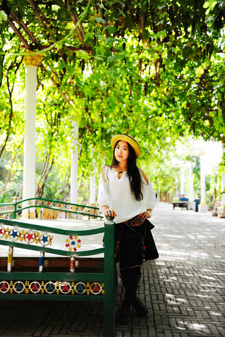
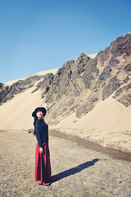
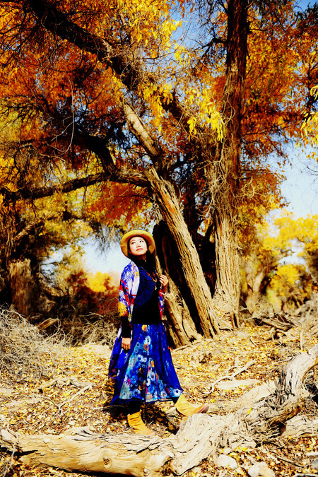
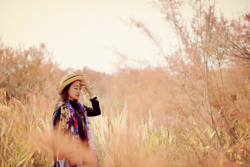
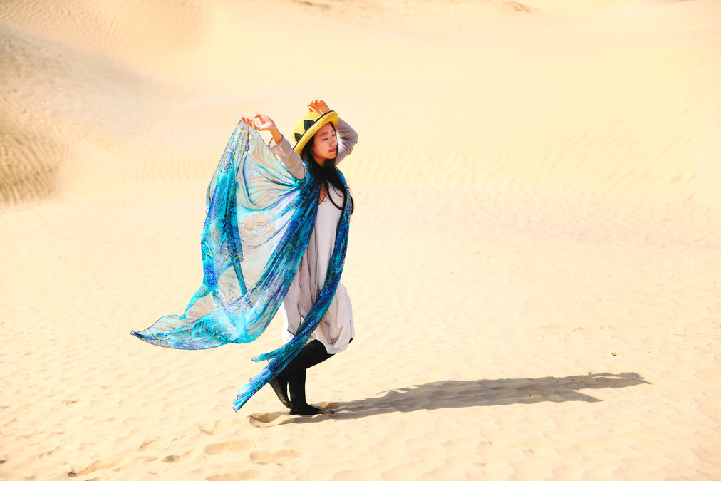
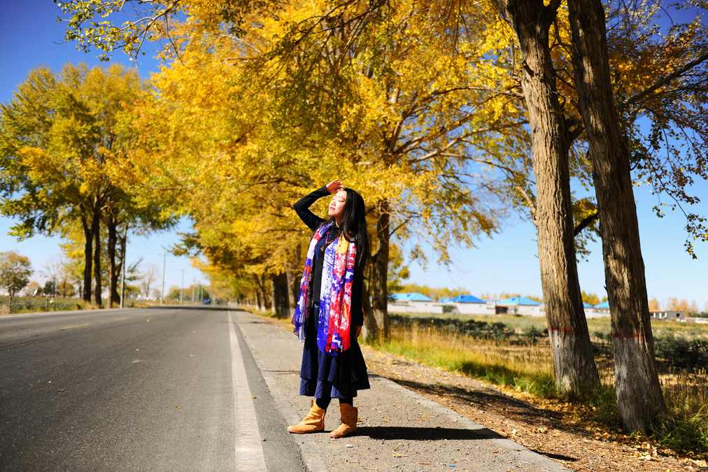
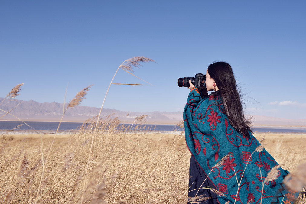
Heading westward, the autumn scenery of southern Xinjiang.
scheduling
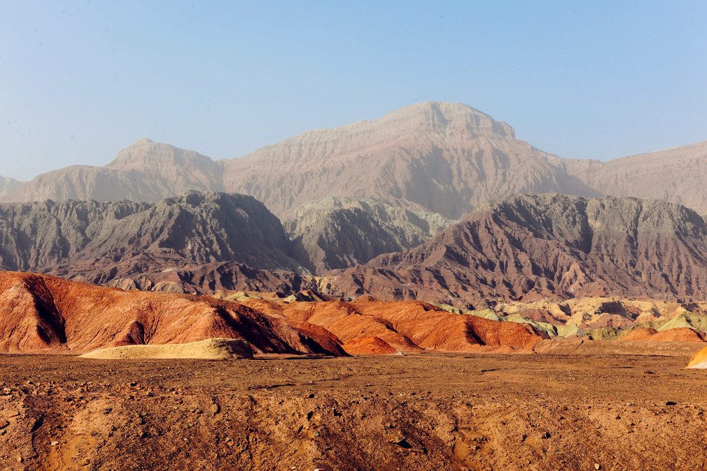
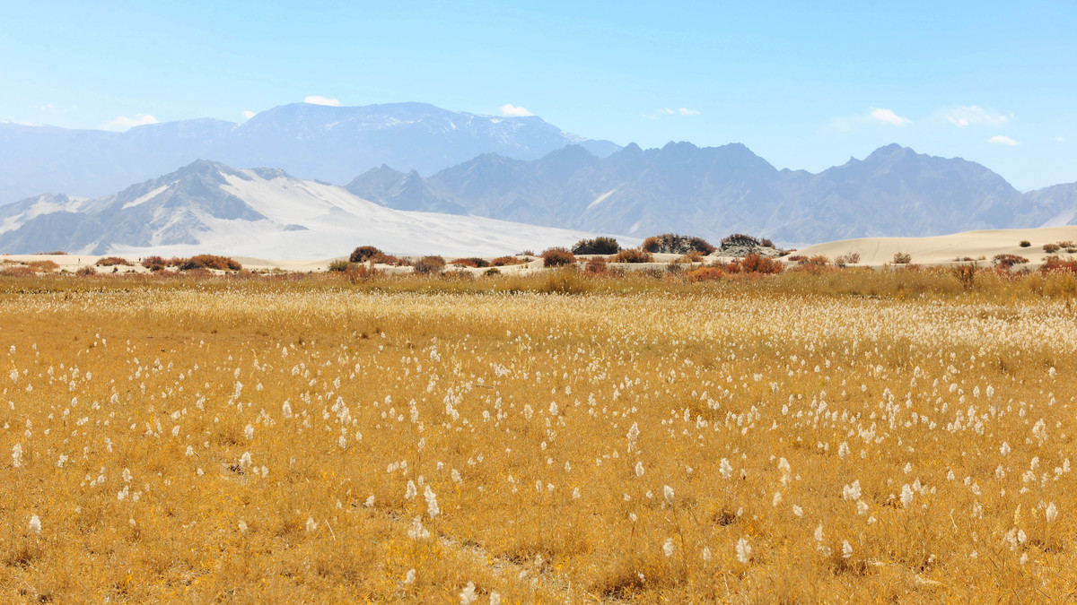
The northern and southern Xinjiang, divided by the Tianshan Mountains, have significant differences in geography and climate. The northern Xinjiang has abundant rainfall, with high mountain grasslands. At Kanas, it snows and the mountains are closed off in October. In contrast, the southern Xinjiang has a dry climate, with annual evaporation far exceeding annual precipitation. It is windy and sandy, and the landforms are mainly composed of Gobi, wind-eroded and desert landscapes, presenting a variety of desolate scenes.
This season, I went to southern Xinjiang mainly for the two major poplar forests of Tarim and Golmud, which are at their most beautiful in autumn. Along the way, I also visited Li Jia Shan, Mogao Grottoes, Bosten Lake, Kizil Devil City, Qianfodong, Kashgar Old Town, Taklimakan Desert, Chaka Salt Lake, Foguang Temple and other scenic spots. There were times when I was purely on the move, and there were also places where I slowed down to rest and adjust. In fact, many beautiful scenes are along the way.
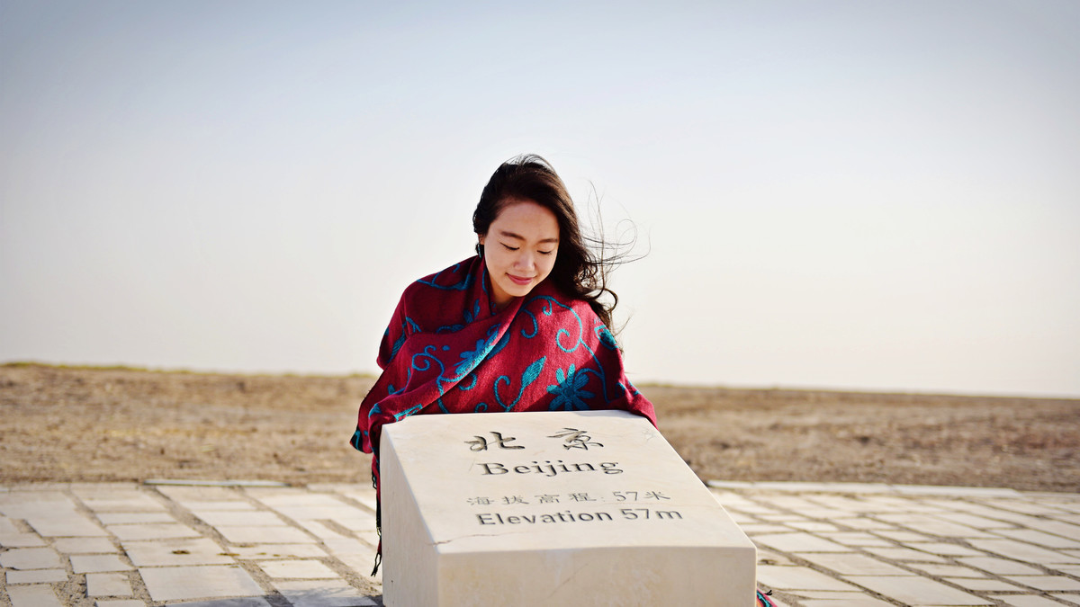
We set off from Beijing by car on the afternoon of October 2nd, heading for southern Xinjiang. Along the way, we passed through Lüliang, Zhongwei, Dunhuang, entered Xinjiang from Turpan, and then headed westward through Korla, Baicheng, Aksu until Kashgar. After that, we turned back and followed National Road 315 through Hotan, heading towards Qinghai, passing through Golmud and Delingha, and then returned to Beijing via Dingbian and Xining.


----------------------------------------------
DAY1
Beijing - Fenyang: 567 km
Pure driving ----------------------------------------------
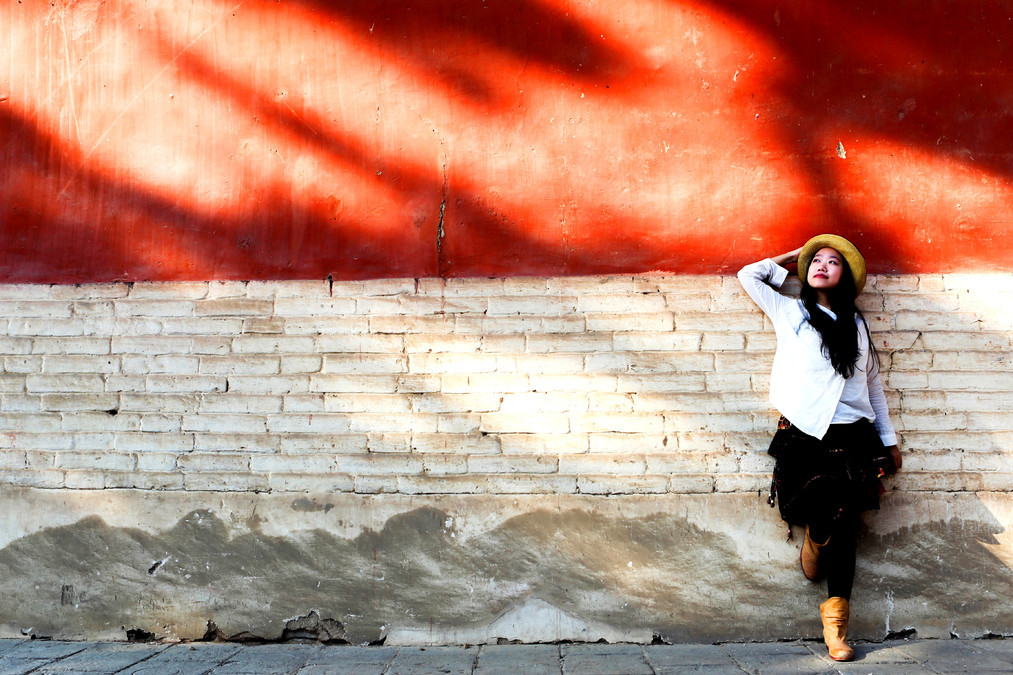
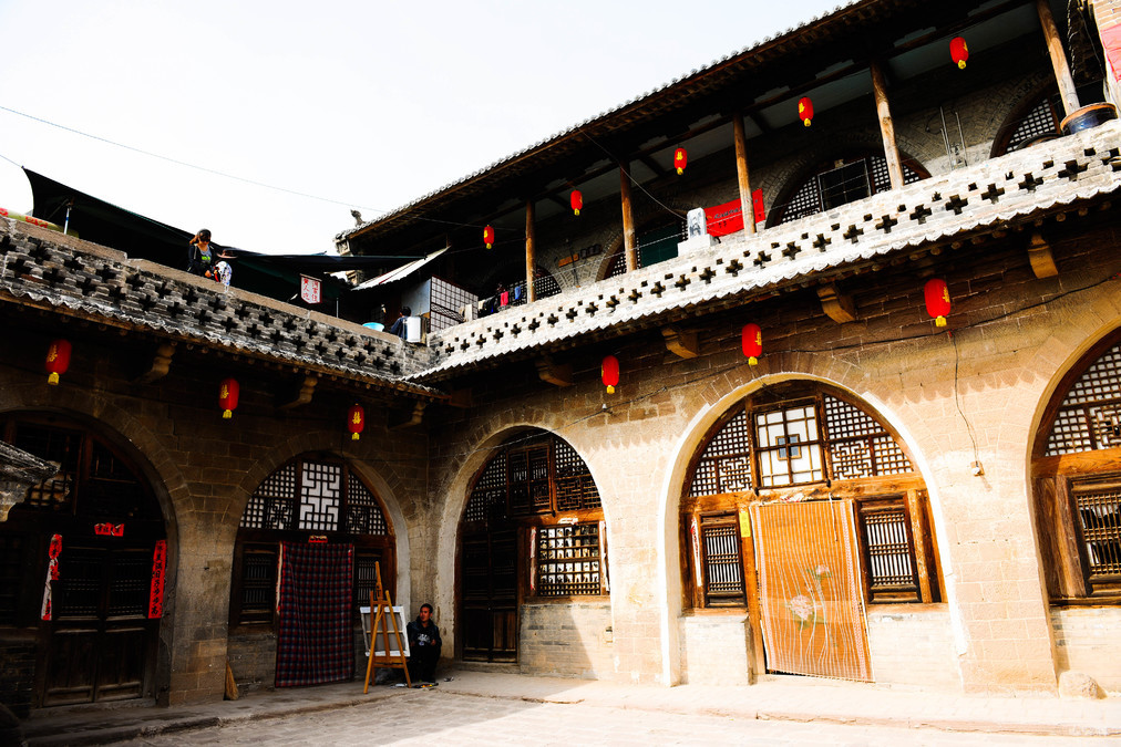
Lüliang, Shanxi Province: Qiuc Town and Li Jiashan
----------------------------------------------
DAY2
Fenyang - Qiuchao: 150 km
Lijiashan - Zhongwei: 575 km
Attractions: Qiuchao Ancient Town, Lijiashan
----------------------------------------------
In the explanations of "qi" in the "Shuowen Jiezi", it is defined as "a shallow area in water where there are stones", referring to the shallow parts of the water. The name "Qiugou" comes from the second largest sandbar adjacent to it - the Datong Sandbar (the largest one is the famous Huituofu Waterfall). Due to this sandbar, in the past, merchant ships coming from the upper reaches of the Yellow River were blocked here and had to change to the land route instead. Qiugou once developed very prosperously as an important water and land transportation hub until later, when roads and railways were built, water transportation was eliminated, and due to the impact of wars, Qiugou gradually declined. However, the buildings from the Ming and Qing dynasties on the street have been preserved and maintained, telling the vicissitudes of this ancient town.
There are still many old pawnshops and shops on the street, but not many of them are still open. Now the main source of income here is tourism. Many of the old buildings have been converted into hotels. The traditional architecture in the northwest is cave dwellings, but in Qiuchou Town, due to the flat terrain, there are also many brick and wood structures on the main street. In contrast, the ancient villages of Xiwang and Li Jiashan have more distinct cave dwelling features.
This is a town full of ancient charm. If you come here and see the old man dressed in the coarse cloth jacket from the northwest, leading the brightly decorated donkey to attract tourists to take photos; or the grandma setting up a stall with a plank at the old pawnshop door, selling common items everywhere; or the couple who only have a simple shed and shouting to the passers-by to come to their home for a bowlful of suktur (a local dish); please consider giving them some business! It is they who keep this town vibrant and allow people to occasionally recall the ten-day gatherings once a month, and the folk dance and drumming performances during festivals.
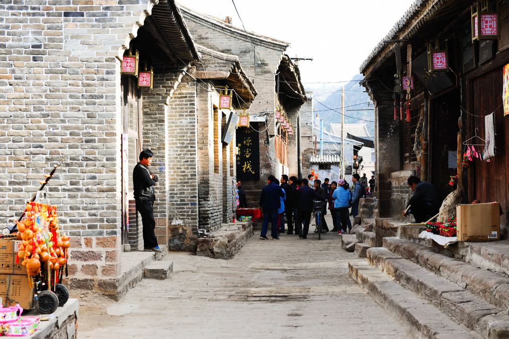
On both sides of the winding cobblestone path, the dark-colored bricks and the tall stone walls made of Yellow River pebbles blocked the secrets within the courtyard. However, the green branches of the jujube trees broke through the walls and emerged outside. And on the opposite wall, the manger where horses were once tied was where the tall and powerful horses belonging to the rich man or the camels and mules used for transporting goods were kept. No one knew for sure whether those were the horses or the camels and mules.
The town is not large. Climbing to the top of the Longhu Temple offers a panoramic view of the entire Daxingqi area and the entire town of Qiuguo. In the summer of 2011, I, along with three other classmates, spent most of the day on a train in Luliang to write books for Lijiasan and Xiwang and to make plans for Lijiasan. At that time, the local tourism bureau staff received us and briefly introduced the local situation. At that time, neither Lijiasan nor Qiuguo had so many tourists. The Longhu Temple did not hear the loud sound of the suona, and the Qiushui River was not as dry as it is now.
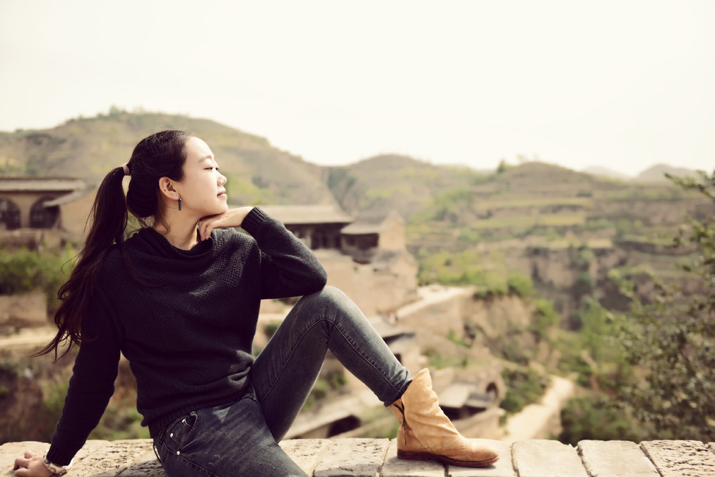
The ancient village of Li Jiashan is not far from Qiucuo Ancient Town. This place is truly like another home for me in Shanxi. Four years ago, I stayed here twice for a short period and, together with another classmate, explored every corner of the village and visited every resident. After making a plan, I spent more than a year writing the book "Series of Ancient Villages in Shanxi: Li Jiashan", feeling about Li Jiashan was like treating an elder who has accumulated cultural heritage over time, or like treating a child who has invested countless efforts.
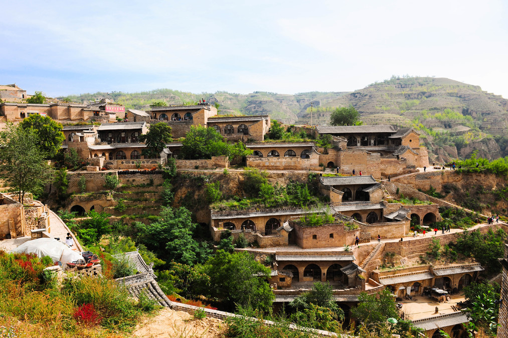
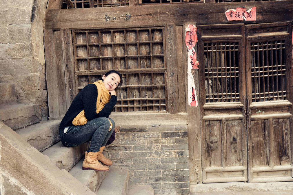
The entire Li Jia Mountain Village is divided into three slopes by two gullies, forming the shape of a phoenix. The cave dwellings are built along the terrain, neatly distributed on the body and wings of the phoenix. In the past, when agriculture was the main occupation, people would choose to cultivate the slightly gentler areas on the mountain and build houses on the steeper areas. This was beneficial for farming and made the living areas safer and more conducive to drainage.
Lijiashan is a typical village with cave-style architecture. The Li family moved here over 500 years ago. During this period, the village's development was full of ups and downs. There were wealthy families, officials and dignitaries, as well as heroes who fought against the Japanese invaders and artistic groups.
The remaining buildings nowadays are mostly cave dwellings from the Ming, Qing and Republican eras, possessing high architectural art and craftsmanship value. Among them, those that have been well preserved and are of great historical significance include the West Wealthy Landlord's House, the East Wealthy Landlord's House, the New Cave House, the Li Jianxin House, the Three-Layer House, the Dong Sheng House, and the Tian Guan Temple.
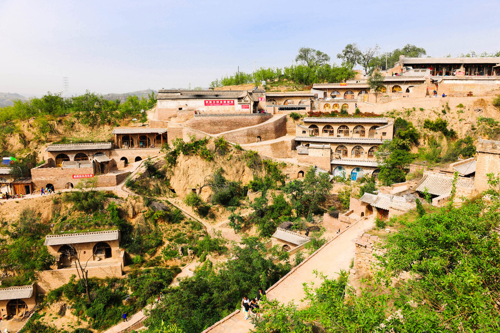
But now, due to poor transportation and the lack of resources in the mountains, young people have been moving down to the cities to seek jobs. New villages, such as Li Jiashan New Village, have been built at the foot of the mountains. Only those elderly people who are reluctant to part with their roots are still tending to that small piece of land. In recent years, after the tourism industry in Qiuchou developed, the homestays in Li Jiashan have also been booming. Perhaps this is one way to attract young people to return to their hometowns for employment.
After a four-year absence, upon returning, I found that this place had undergone many adjustments based on the plans we had made at that time. The up-and-down roads had been renovated, an additional parking lot, public toilets and information boards had been added, and the living facilities had been improved. The entire village had become much cleaner and tidier. Previously, it was an old and quaint village visited mostly by artists. Now, it has become a popular tourist attraction. However, the villagers remain so simple and pure.
After having lunch in Li Jiashan, we continued our journey westward and stayed in Zhongwei.
----------------------------------------------
DAY3
Defensive midfielder - Guajiao: 1000 km
Just traveling without stopping
----------------------------------------------
I ate lamb for dinner that night. Maybe I was affected by the wind. The next day, I started experiencing stomach cramps. I threw up all the way in the car, and it was extremely painful. Originally, I was planning to reach Dunhuang that day. I stayed at Guizhou until I reached the limit and then took the highway to go to the hospital.
Gansu Dunhuang: Mogao Caves
----------------------------------------------
DAY4
Guajiao - Mogao Caves: 120 km
Mogao Caves - Turpan: 883 km
Attraction: Mogao Caves
----------------------------------------------
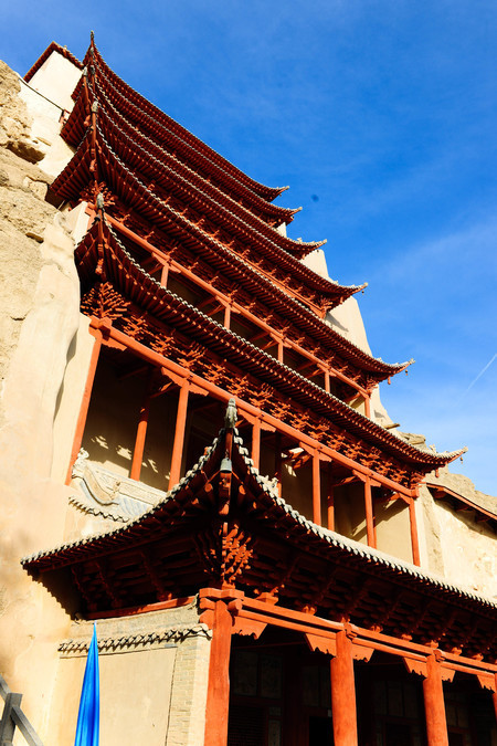
The Mogao Caves, also known as the Thousand Buddha Caves, are located in Dunhuang at the western end of the Hexi Corridor. They were first built during the early Qin Dynasty of the Sixteen Kingdoms period. Over the centuries, they have been continuously expanded by various dynasties including the Sixteen Kingdoms, Northern Dynasties, Sui Dynasty, Tang Dynasty, Five Dynasties, Western Xia Dynasty, and Yuan Dynasty. As a result, they have reached a huge scale, with 735 caves, 45,000 square meters of murals, and 2,415 clay statues. It is the largest and richest existing Buddhist art site in the world. In 1987, the Mogao Caves were listed as a World Cultural Heritage Site.
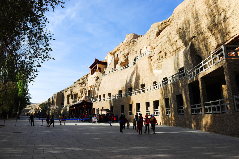
Getting intravenous fluids in the hospital was very effective. The next day, I was fully recovered. So I got up early to queue up in Dunhuang. Because it was the 11th, the number of tourists visiting Dunhuang was unimaginably large. Because the hotel only received 6,000 tourists per day at night, we got up very early to queue up to wait for the opening. But in fact, I thought there were more than 6,000 people... Because unlike the regular tickets that allowed you to visit up to ten caves, during the 11th, special tickets were sold, costing 100 yuan to visit four caves. And during the viewing process, the tour guide only gave a few brief explanations before asking everyone to leave quickly, so the flow was very fast, and we could finish all the visits in an hour.
After visiting the Mogao Caves, we drove all the way to Turpan.
Turpan, Xinjiang: Ayding Lake and Grape Valley
----------------------------------------------
DAY5
Turpan Day Tour
Scenic spots: Fire Mountain, Aidi Lake, Grape Valley, Karez Canal
----------------------------------------------
Turpan was a major city on the ancient Silk Road. Human activities had already taken place there as early as the Neolithic Age, approximately 6,000 to 7,000 years ago. Turpan is located in the mountainous basin in the eastern part of the Tianshan Mountains and has a desert climate. It remains an important transportation hub to this day and is one of the most representative regions in Xinjiang, with abundant tourism and cultural resources.
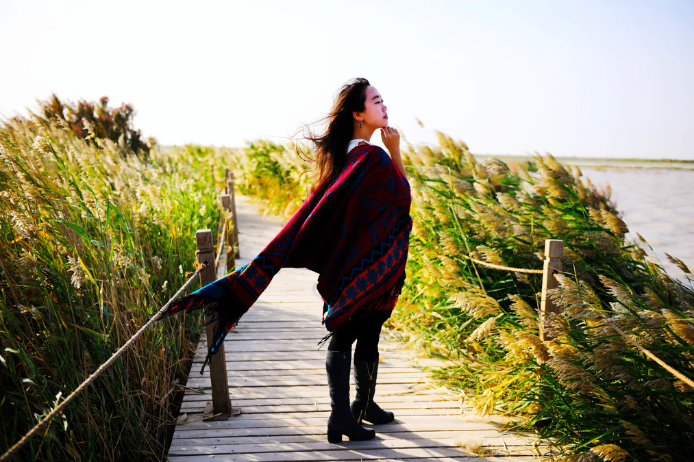
Last night, we drove to Turpan. Since we were going to stay for two days, we could adjust our plans. Today, we spent the day exploring Turpan. In the morning, we set off to visit the Flaming Mountain first. We found that the smog was quite severe. Not only was it impossible to see the blue sky, but even the mountain peaks were unclear. So we turned back and went to the Ayding Lake, which we had found out about last night but hadn't visited before.
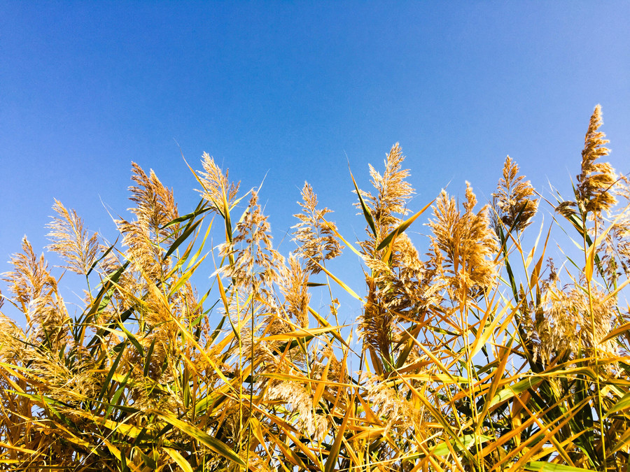
The name of Ayding Lake in Uyghur language is called Chēn Aidingkulü, which means "Moonlight Lake". It is easy to imagine that the Ayding Lake was very beautiful in the past. And its geographical value is more famous than its scenery - the lake surface is about 155 meters below sea level, making it the lowest point in Chinese mainland and the second lowest place in the world after the Dead Sea in Jordan.
In this area where the annual evaporation is several times greater than the precipitation, the former sources of water supply for the Ayding Lake were the summer floods of rivers, the winter flow of karez wells, and the drainage from irrigation areas. However, since the 1950s, due to the expansion of irrigation areas and the increase in water diversion for farmland, the flood supply from rivers has decreased, and the karez wells store water for irrigation, also reducing the water supply to the Ayding Lake. Currently, the main source of water supply is only underground runoff. As a result, most of the lake basin has dried up.
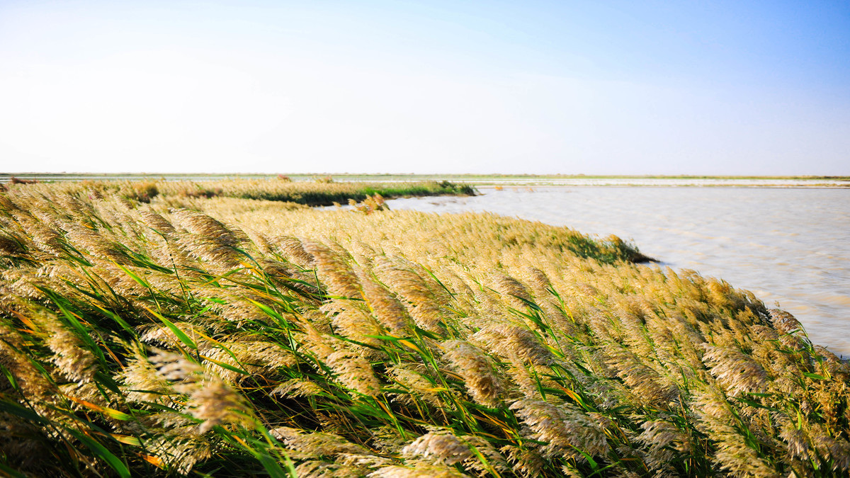
Compared to that, the vast expanse of reeds by the lake made me feel even more beautiful. Because no one was around, I could only hear the rustling sound of the wind through the reeds and see the gentle ripples on the water surface.
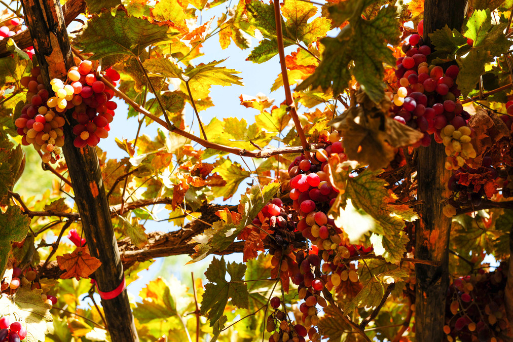
At lunchtime, we went to the Grape Valley. To be honest, when we returned to the Grape Valley after an 11-year gap, that towering and imposing entrance to the scenic area really scared the entire group of us. And once we entered, due to the vast size of the scenic area, we were scared again. Driving for half a day, we still didn't know where the "valley" was. What a mess! In essence, the question is: How did this valley full of grapes under the Flaming Mountain become so popular?
Opening period: October 21st - April 20th
Opening hours: 10:00 - 18:30
Best time: Around August
Ticket price: 75 yuan
After visiting the Grape Valley, we went to the Karez system. It is one of the three major ancient projects in China, along with the Great Wall and the Beijing-Hangzhou Grand Canal. It is an irrigation system designed to utilize groundwater for development in arid regions. It's good to learn about this knowledge, but nowadays it has become overly commercialized, with only a small area designated as a museum while the majority of the area is used for selling goods...
Opening hours: 08:00 - 17:00
Ticket price: 40 yuan
Xinjiang Ba'ao Prefecture: Bosten Lake
----------------------------------------------
DAY6
Tulufan - Bosten Lake: 386 km
Bosten Lake - Kurler: 28 km
Attractions: Dabancheng, Bosten Lake
----------------------------------------------
We set off very early in the morning, hoping to visit the White Poplar River Devil City. However, there was very little information about this Devil City. We checked both paper maps and online maps, driving back and forth for dozens of kilometers. Later, based on the location found on Baidu Maps, it really didn't seem right. The location should be approximately the same, near Dabansheng, but the road was difficult to navigate and there were no road signs. The scenery was also quite ordinary. So we had to abandon the plan to go in the direction of Kulei and instead enjoyed the scenery along the way.
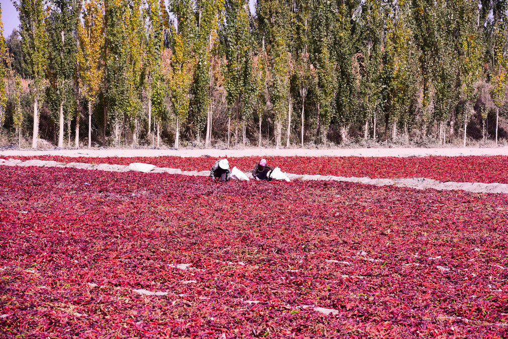
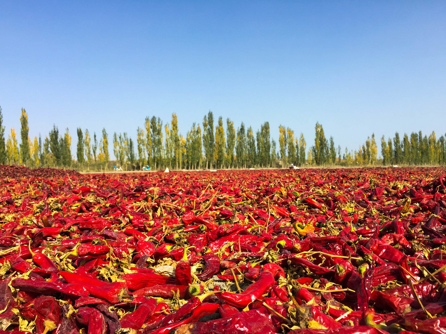
The climate in southern Xinjiang is dry, making it unsuitable for growing many crops. Especially, there are even fewer vegetables that can be stored during winter. As a type of chili pepper that can achieve high yields locally, is easy to dry and store, and is rich in vitamins, it is an indispensable part of the local people's diet. While driving on the roads in southern Xinjiang, one can see farmers drying chili peppers everywhere.
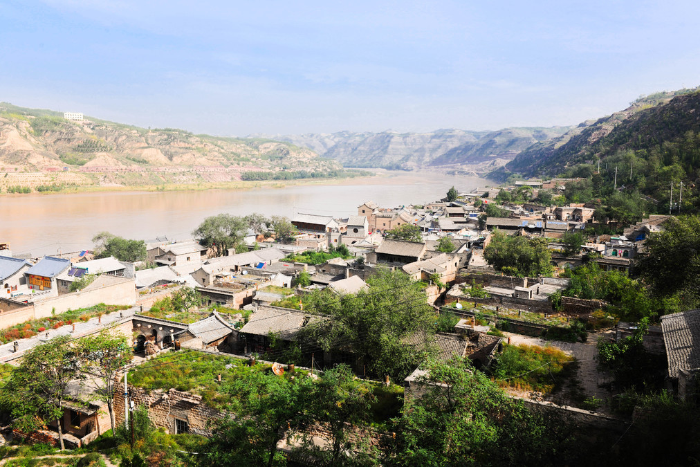
We arrived at Bosten Lake in the afternoon. It is the largest inland freshwater lake in China. It is called Bostener in Mongolian, Baglarashkul in Uyghur, and was formerly known as Xihai. In "The Book of Han: Records of the Western Regions", "The King of Yanchi arrived at the city of Zhaonqu, and southward to Weili, a distance of a hundred miles, with abundant fish near the sea" and "Dun Hongpu" in "The Waterways Geographical Record" both refer to this lake.
This lake is very large and is a national 5A-level scenic spot. Admission is required to enter, and there is no road around the lake for a full circuit. It is divided into several scenic areas - Jishan Beach Beach Resort, Ahongkou Tourist Area, Yangshui Station, Dahekou, and Bai Luozhou. Jishan Beach is quite famous. The main reason is that it is quite far from the sea, and finding a place that can serve as a beach resort is not easy. Jishan Beach needs to be reached from the north side of the lake. Because the road is too difficult to travel, we gave up after driving for a while and turned back to the core scenic area of Dahekou on the west side.
Perhaps it was due to the weather. The sky wasn't very blue and the color of the lake wasn't appealing, so it seemed rather ordinary. There were many birds, circling in the reed beds in the distance. Their voices could be heard but their figures could only be glimpsed occasionally. As it was very boring, I wandered around for a while and then left. I stayed in Korla that night.
Bazhou, Xinjiang: The Populus tomentosa Forest along the Tarim River
----------------------------------------------
DAY7
Kulul - Tarim River Poplar Forest: 250 km
Tarim River Poplar Forest - Kuqa: 185 km
Attraction: Tarim River Poplar Forest
----------------------------------------------
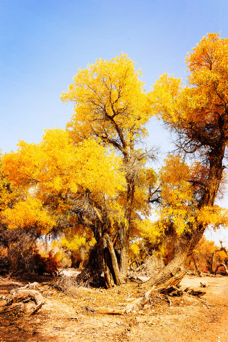
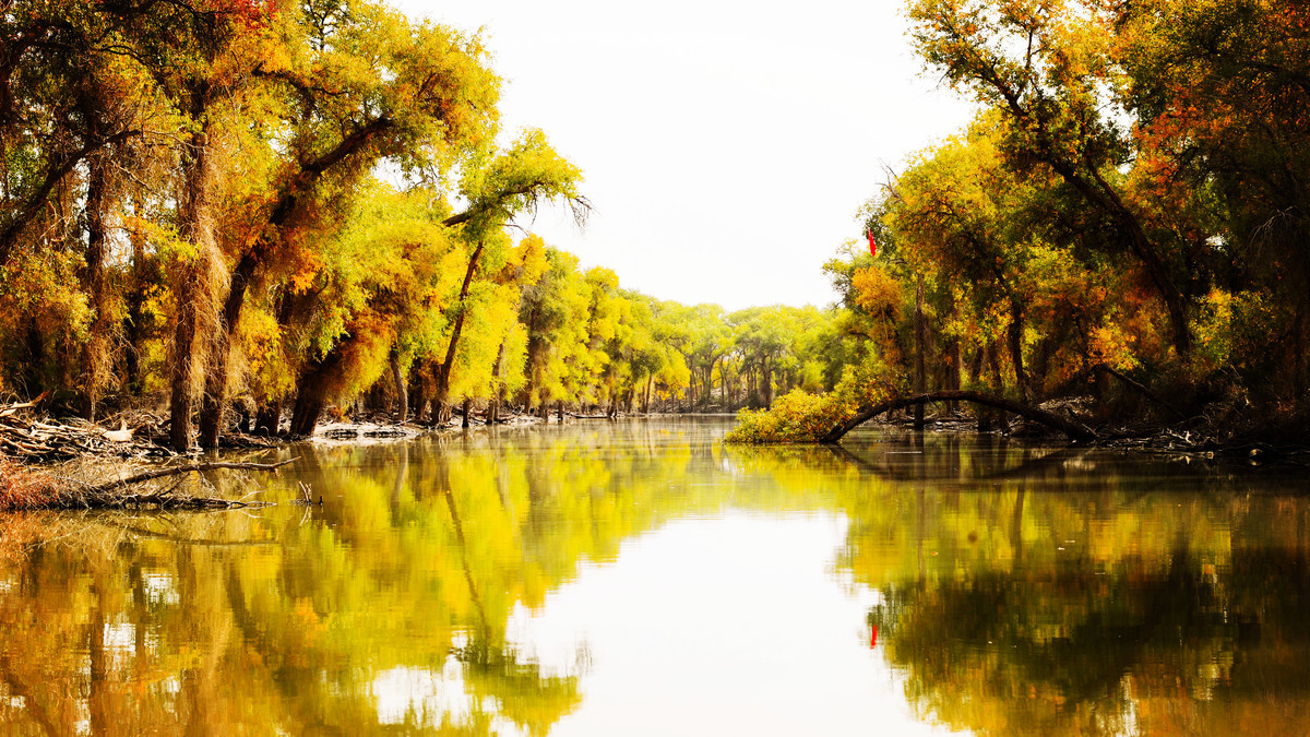
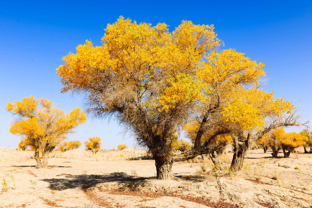
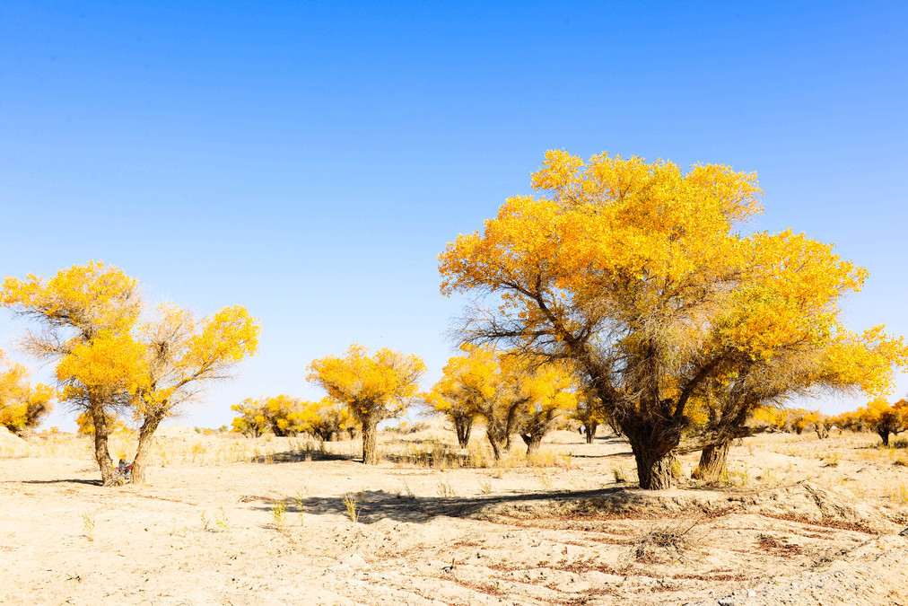
The highlight of this trip is the today's Tarim Populus euphratica Forest Park. The entire park covers an area of 100 square kilometers. It is located 70 kilometers south of the Wulanhe River in the middle reaches of the Tarim River, on the northeastern edge of the Taklimakan Desert. It is the largest original poplar euphratica forest park in Xinjiang and the most concentrated area of original poplar euphratica forests in the entire Tarim River Basin. In fact, there used to be a large area of poplar euphratica forests along the Tarim River, but later, due to natural and human factors such as arid climate and agricultural transformation, along with the drying up of the river, most of the poplar euphratica forests died. This park is one of the relatively intact areas of poplar euphratica forests in the Tarim River Basin.

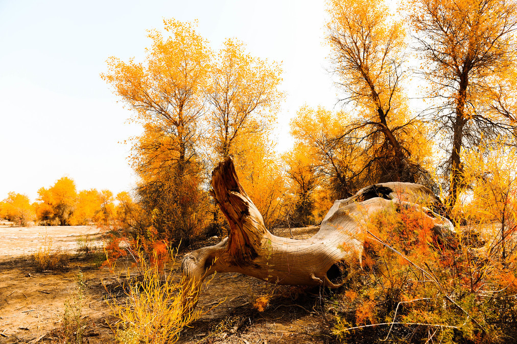
The world's three major original poplar forests are located in the Sahara Desert in North Africa, the Tarim River in Xinjiang, and the Ejina area in Inner Mongolia. The Tarim Poplar Forest National Forest Park integrates the natural landscape of the Tarim River, the poplar landscape, and the desert landscape. It is the oldest, largest, most intact and most original poplar forest reserve in the world.
Most of the Chinese poplar forests are located in China itself, and 90% of these poplar forests are in the Tarim River Basin. Therefore, this poplar forest park is much larger than that of Ordos. I'm a bit at a loss as to how to enjoy it...
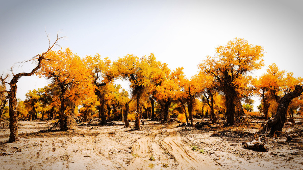
The sightseeing and scenic area consists of a 17-kilometer-long tour road with 126 bends and various landscapes of the red poplar trees along the way. At the end, there is a 13-kilometer-long circular tour railway and several lakes in the forest. Due to abundant rainfall this summer, the area at the end was affected and flooded by water. The small train could only run for a short distance, so we took a small boat instead. However, this is not actually a lake in the scenic area; it can only be called a large reservoir formed by the accumulated rainwater. The lake area is impassable. For this area's red poplar forest, it is still a bit early at this time.
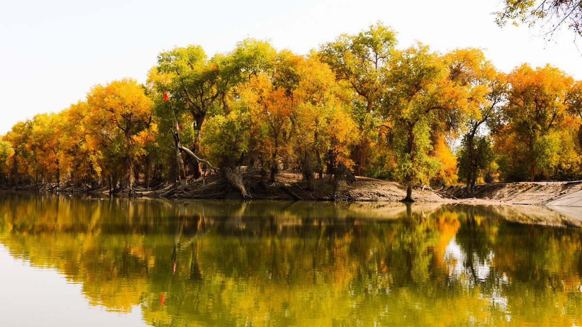
In principle, cars are not allowed to enter the scenic area. Once inside the area, you can take the local buses to visit various points along this 17-kilometer tour route. The buses come approximately every 20 minutes. The final destination is the circular lake scenic area at the end. The scenic area is quite large, and the poplar forests are not all the same color. When purchasing tickets, the staff will say that certain sections are more colorful and beautiful at this time, so the viewing period can be very long. For example, when we came, the most beautiful parts were at the 3-kilometer, 9-kilometer and 14-kilometer marks.
Actually, there are more small poplar trees and red willows along the roadside. However, there are far more mosquitoes... Everyone knows that mosquitoes are rampant and destructive in the Xinjiang border area. The mosquitoes in this park are so numerous that they can literally eat a mouthful of flesh with one bite. And it is said that after the recent cleanup, 70% of them have been removed. It's truly unimaginable how terrifying it was before the cleanup. I could easily kill ten or so mosquitoes with one slap. It's truly a hell for people with agoraphobia. So, although it's hot and sunny, we dare not expose ourselves too much. Fortunately, the bites are not particularly severe, but once a bite causes a swelling, it can become very large. Therefore, no one dares to play for too long in this environment. It's really very challenging. As soon as a vehicle arrives, we quickly get on.
Although the area of yellow color in the entire scenic area is not very extensive - it will be at its best in about two weeks - it's still quite nice to be able to see a few beautiful ones. The tall and beautiful poplars, with their thick roots and branches, are telling the story of their determination to survive in the desert, seeming even more dazzling than their golden leaves all over their bodies.
We spent a whole day here, then continued traveling westward. Today we didn't cover much distance, and we will stay in Kuqa tonight.
Aksu, Xinjiang: Kizil Devil City and Thousand Buddha Grottoes
----------------------------------------------
DAY8
Kuqa - Kizil Thousand Buddha Caves: 67 km
Kizil Thousand Buddha Caves - Kashgar: 768 km
Attractions: Kizil Devil City, Thousand Buddha Caves
----------------------------------------------
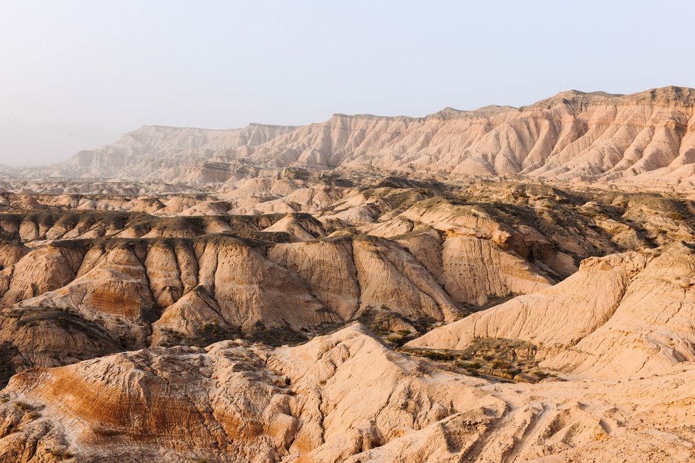
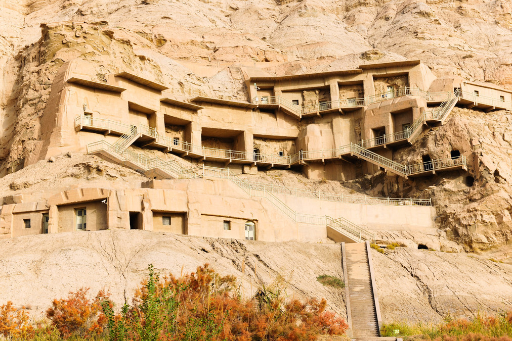
Today, we took a detour to Baicheng from the north. Baicheng was once the territory of Guimo Kingdom and Kuizhi Kingdom during the Han Dynasty. It has a long history and rich culture. The Kizil Thousand Buddha Caves, which still exist today, are called "the second Dunhuang of China". This area is all composed of wind-eroded Yadan landforms, thus forming the "Kizil Devil City". Generally speaking, what is called "devil city" refers to places with typical Yadan landforms.
The Kizil Thousand Buddha Caves in Baicheng are a group of Buddhist grottoes. They were excavated approximately from the end of the 3rd century to the middle of the 4th century. There are currently 236 grottoes, among which over 80 have preserved murals, covering an area of more than 10,000 square meters. Only 6 of them are open for public visit.
In the 19th century, Western exploration teams led by Germans and Englishmen came here and removed a large number of murals and Buddha statues. Later, they were damaged by religious activities of Muslims. Moreover, affected by natural factors such as wind erosion, floods and earthquakes, most of the Buddha caves are now in a dilapidated state. Currently, the main focus is on protection and restoration.
As we were approaching Kashgar, there was a beautiful stretch of scenery on the highway. The colorful landscape was probably due to the colors of the minerals contained within. We arrived in Kashgar at night.
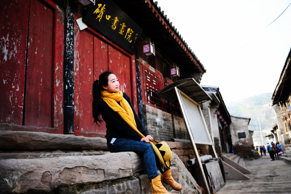
Kashi, Xinjiang: The Old City of Kashi
----------------------------------------------
DAY9
Kashi - Pamir Plateau: 288 km
Kashi - Hotan: 503 km
Attraction: Kashi Old City
----------------------------------------------
The original plan was to go to the Pamir Plateau today. "Pamir" is the Tajik word for "the roof of the world", referring to the junction of two huge mountain ranges on Earth (the Alpine-Himalayan range and the Pamir-Chukotka range). The plateau has an altitude of 4,000 meters to 7,700 meters and contains many peaks. Its highest peak is Jogoeri Peak (K2 Peak) located in the Karakoram Mountains, on the border between China and Pakistan, with an altitude of 8,611 meters and is the second highest peak in the world after Mount Everest.
But because I didn't do a good job in my previous work, it took us over two hours to drive along the bumpy mountain road to the border checkpoint. Only then did we realize that we needed to obtain a border pass. In Kashgar, it could be done, but we didn't do it. So we had to drive another two hours back to Kashgar, which was quite frustrating. And because we didn't want to waste another day, we decided to give up on this attraction.
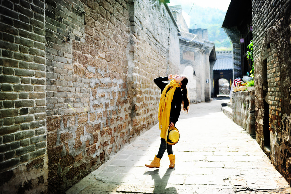
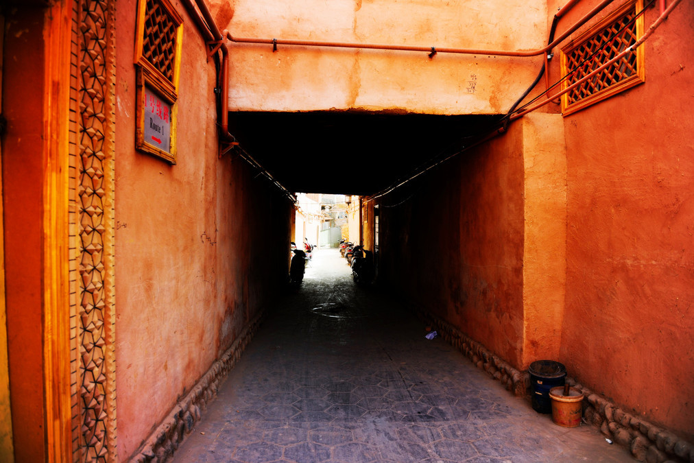
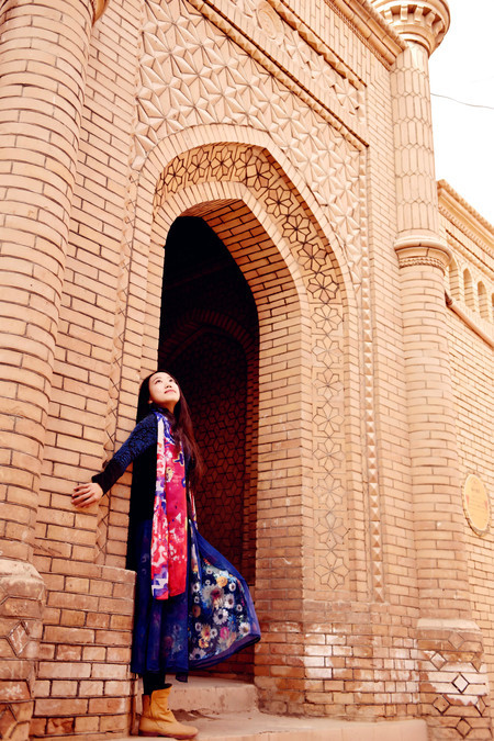
The planned highland visit didn't happen. At noon, I returned to Kashgar and had a meal of Xinjiang lamb skewers and hand-pulled rice. In the afternoon, with the extra time, I went to the old city of Kashgar. Kashgar Old City is located on a high platform in the center of Kashgar, covering an area of 4.25 square kilometers and housing approximately 120,000 residents. The old city of Kashgar has a complex network of streets and alleys, with a flexible and diverse layout. The paths wind through the area, and most of the residences are of earth and wood or brick and wood construction. Many traditional residences have a history of over a hundred years and are the only maze-like urban blocks in China with an Islamic cultural characteristic.
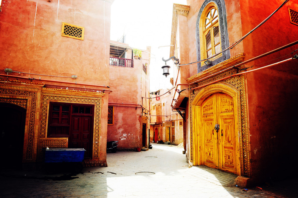
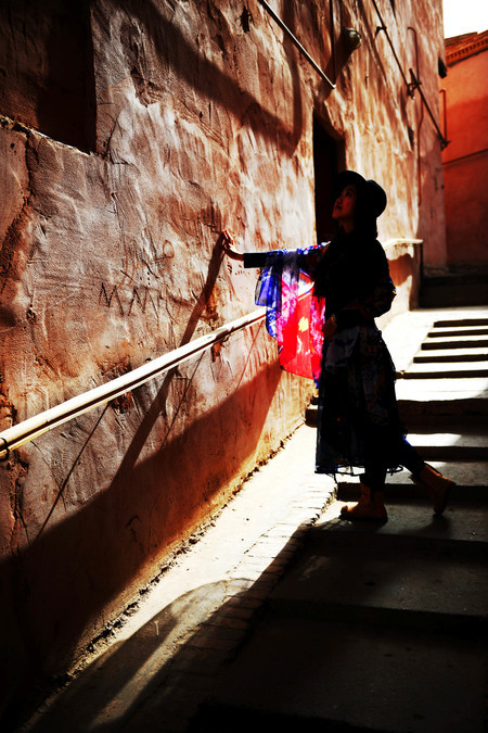
The scenery in the southern Xinjiang is not as beautiful as that in the northern Xinjiang. Many people come to the southern Xinjiang mainly to appreciate its cultural charm. In the quiet old town, the alleys with earthen and stone surfaces are wide enough for donkey carts to pass through, but narrow enough for only two people to walk side by side. The streets and alleys vary in length, turning east and west, south and north, winding and twisting, seemingly reaching an end, but then there is another alley with lush greenery and blooming flowers.
The old city of Kashgar is the main filming location for the movie "The Kite Runner". On the streets and alleys of Kashgar, one can find many familiar scenes.
The facades of the alleys have distinct local characteristics. You can tell whether a house is wealthy by the decoration of its front door. Especially those decorated with bricks and stones are mostly from poor areas. The doors of residential houses all face the alley directly. If you see the door open, it means the owner of the house welcomes guests to visit at any time. If it is half-open, it means you can enter, but it's not certain whether the owner will welcome you or not. And if it is closed, regardless of whether the owner is at home or not, you should not rush to knock on the door.
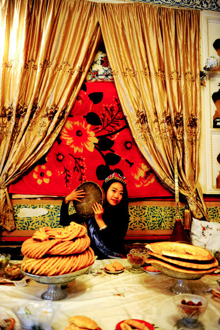
Some of the houses are open for visitors to enter. There is also a living room decorated in the traditional style of the Uyghur people. It has colorful carpets, wall-hung tapestries with distinctive patterns, dishes for entertaining guests on the table, and tambouras placed beside the seats. Tourists can take photos here, while the host enthusiastically promotes the local medicinal herbs sold at his shop.
The residential houses have their unique features. Most ordinary families build two to three floors of wooden and brick structures on a limited area of land. Some extend downward to form basements. The living rooms and bedrooms are connected by wooden ladders or stairs. Every household has a balcony located on the flat roof. Each house has a small courtyard, used for growing flowers or placing bonsai. The bonsai, flowers, and various decorative elements on the columns, wood carvings, and eaves of the buildings all complement each other, creating a harmonious and serene atmosphere.
We hired a guide to give us explanations, otherwise we really would have got lost here. We just drove around briefly and then headed straight to Hotan. It was already 11 p.m. when we arrived in Hotan. We planned to stay for two nights in Hotan and also needed to rest.
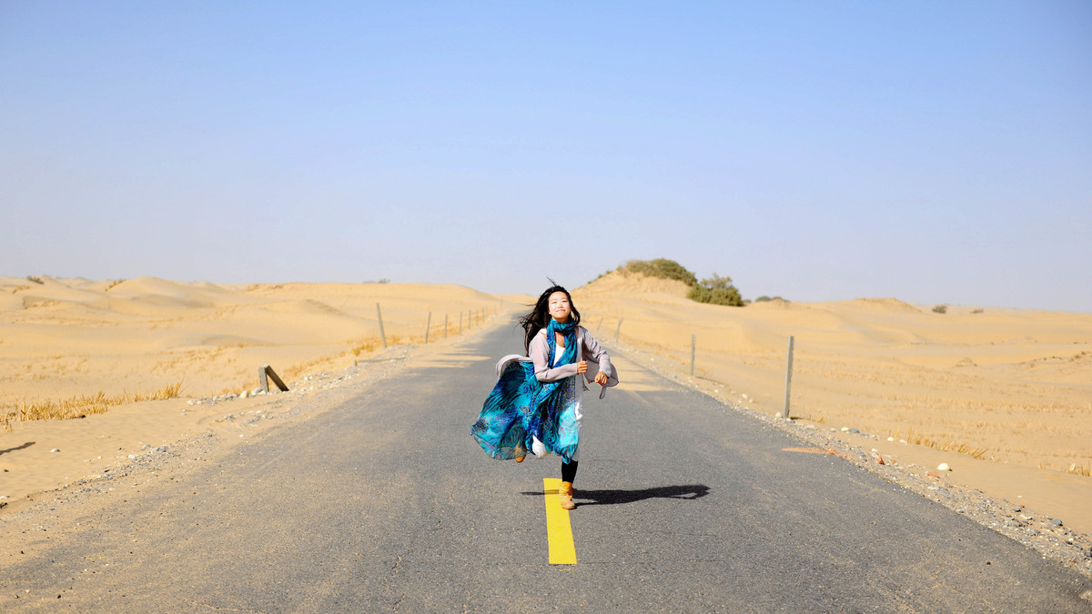
Xinjiang, Hotan: Taklamakan Desert
----------------------------------------------
DAY10
Hetian - Taklimakan Desert - Hetian
Attraction: Taklimakan Desert
----------------------------------------------
Although I arrived late last night, I finally got a good sleep. In the morning, everyone went to the market, but I had no money or interest to buy jade or items from the street vendors. So I continued to sleep. I didn't set off for the Taklamakan Desert near Hotan until around 2 p.m.
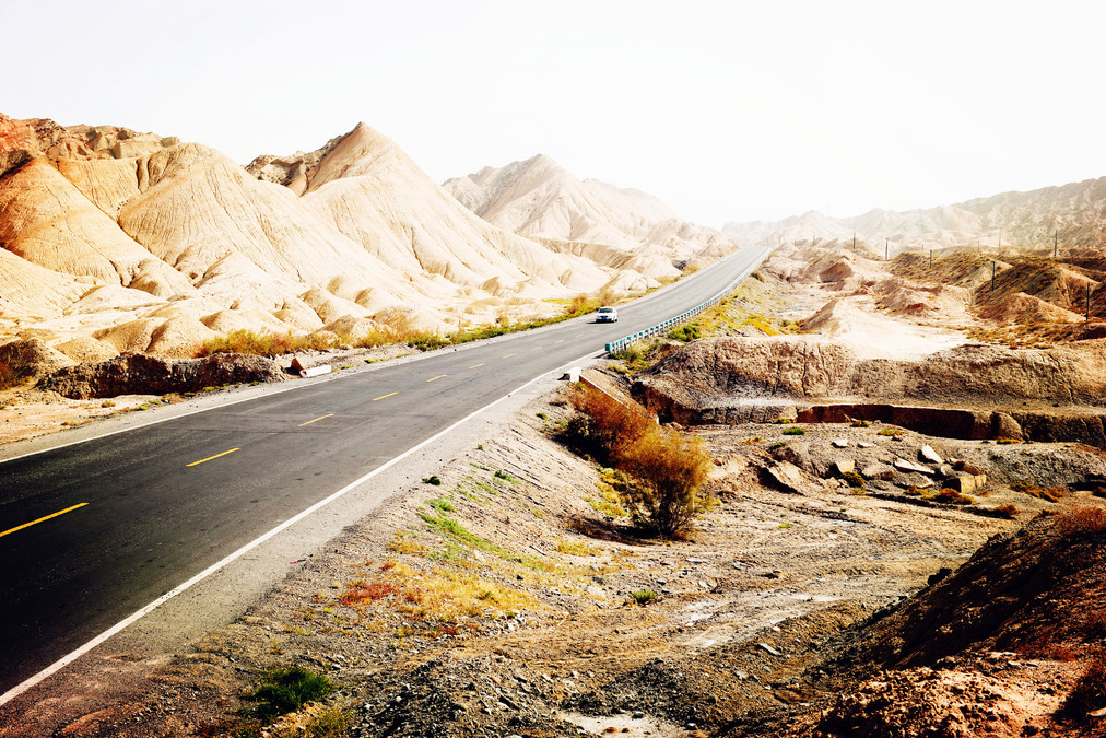
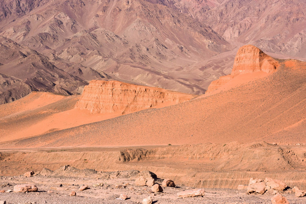
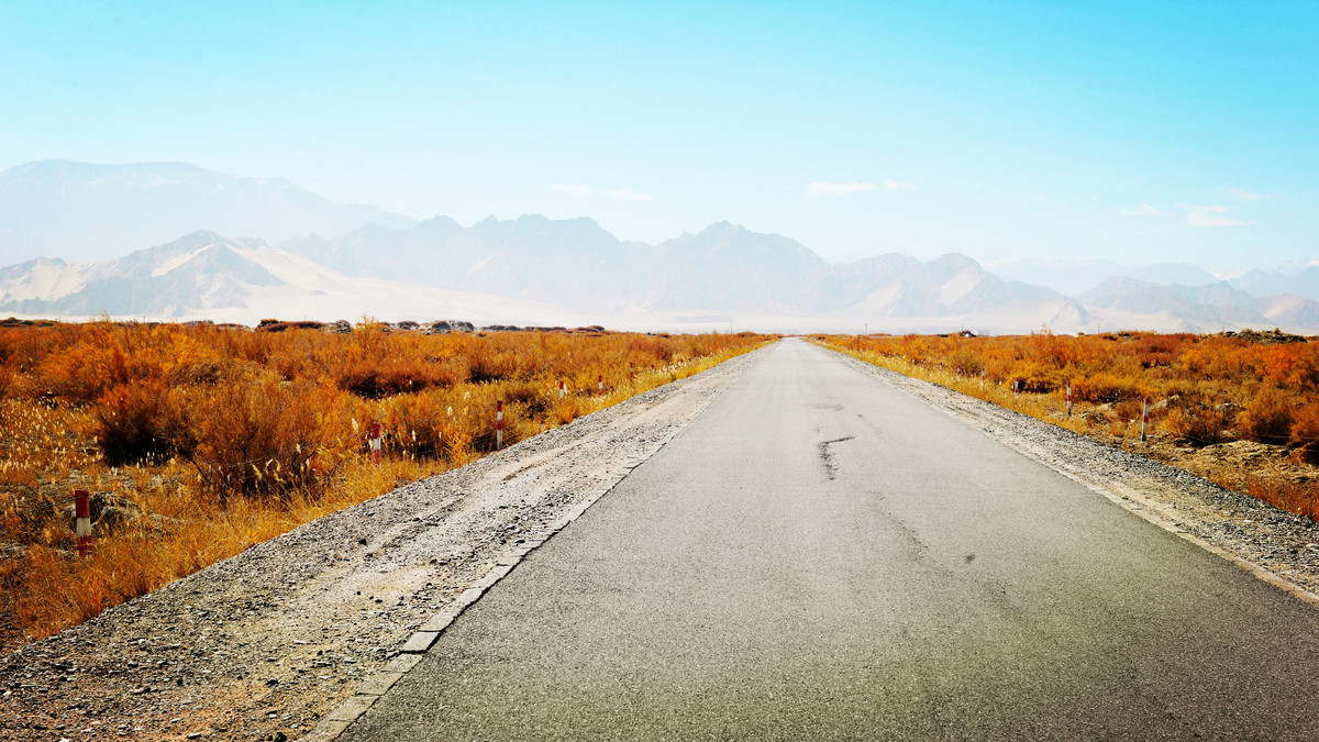
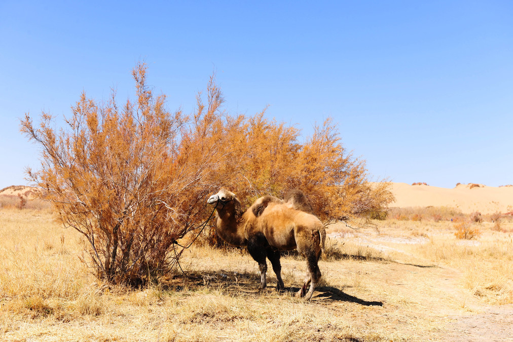
The Taklamakan Desert is located in the center of the Tarim Basin in southern Xinjiang. It is the largest desert in China and the tenth largest desert in the world. It is also the second largest mobile desert in the world. The entire desert is approximately 1,000 kilometers long from east to west and 400 kilometers wide from north to south, covering an area of 330,000 square kilometers.
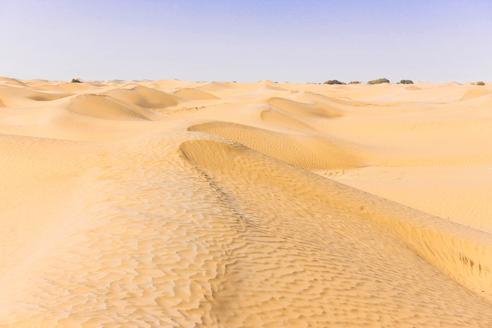
We drove along the Taklamakan Desert Highway to the vicinity of the desert and then played by the roadside. This highway is currently the world's longest grade road that runs through a flowing desert and is also the earliest desert road in China. This place has been the center of the ancient Silk Road since ancient times and is now the main battlefield for oil exploration and development.
The first desert road in China was the Luntai-Minfen Desert Road (completed in 1995, 566 kilometers long), and the second was the Alar-Watian Desert Road (completed in 2007, 425 kilometers long). Building roads in the desert is extremely challenging, and the sand prevention projects must be well implemented to ensure that the roads are not covered by sand.
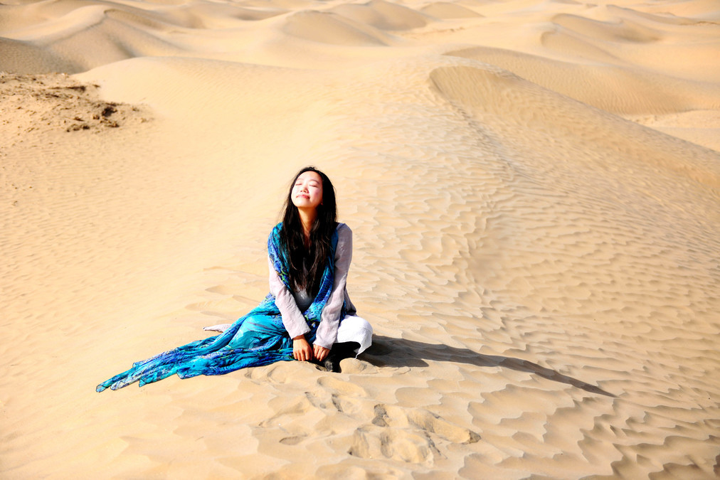
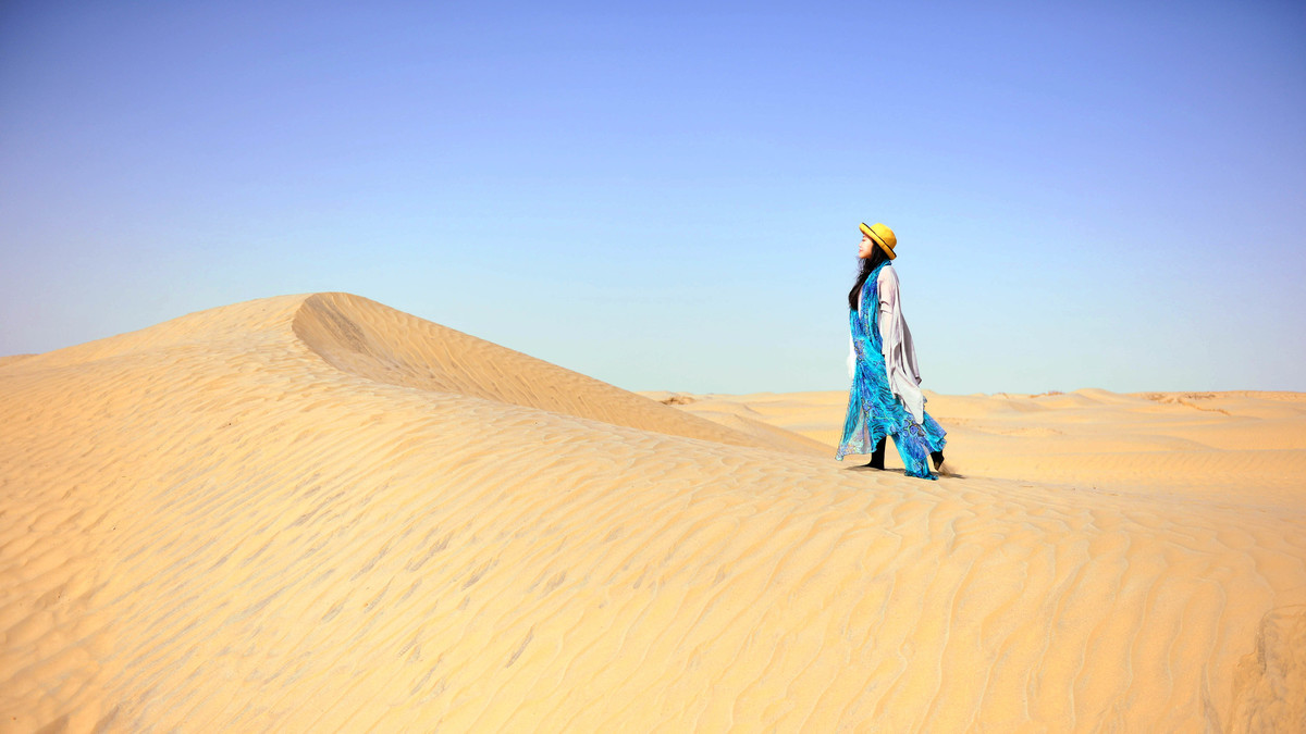
The scenery along the desert highway is very beautiful, but not many people take this route. This is also related to the lack of service facilities along the way. However, since we have managed to carve out a way out of the death zone, I believe things will get better in the future.
Although the desert is almost deserted and is known as the "land of death", it's okay not to go too far. We simply parked the car by the roadside and played on the nearby sand dunes, just touching and patting them.
Xinjiang - Qinghai: 315 National Highway - Poplar Forest
----------------------------------------------
DAY11
Hetian - Huatugou: 1221 km
Attraction: 315 National Highway - Poplar Forest
----------------------------------------------
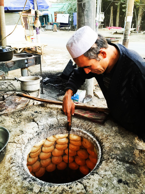
Mom kept talking about the Xinjiang steamed buns all the way. Finally, we got to have them today - previously, it was mainly because we set off too early and according to the pace of the people in Xinjiang, they hadn't even started having breakfast yet.
The elderly Uyghur man is using the oven pit to make the first batch of steamed buns for the day. The dough is combined with fresh lamb meat mixed with onions and cumin. The bottom of the bun is sprinkled with salt and placed in the oven pit. After about ten minutes, the large buns are freshly baked. When you take a bite, your mouth is filled with delicious oiliness, and the flavor of the lamb is extremely strong. The buns and the naan are baked together, and both are very mouth-watering. I still miss the fried dough sticks and tofu pudding in old Beijing.
The 315 National Highway starts from Xining and goes all the way to Kashgar. We followed the 315 road and headed towards Qinghai. After passing through Hotan, the 315 road beyond Hotan was truly breathtaking. Suddenly, in the desert on both sides, there appeared patches of golden poplar trees - this was undoubtedly the biggest surprise of the day!
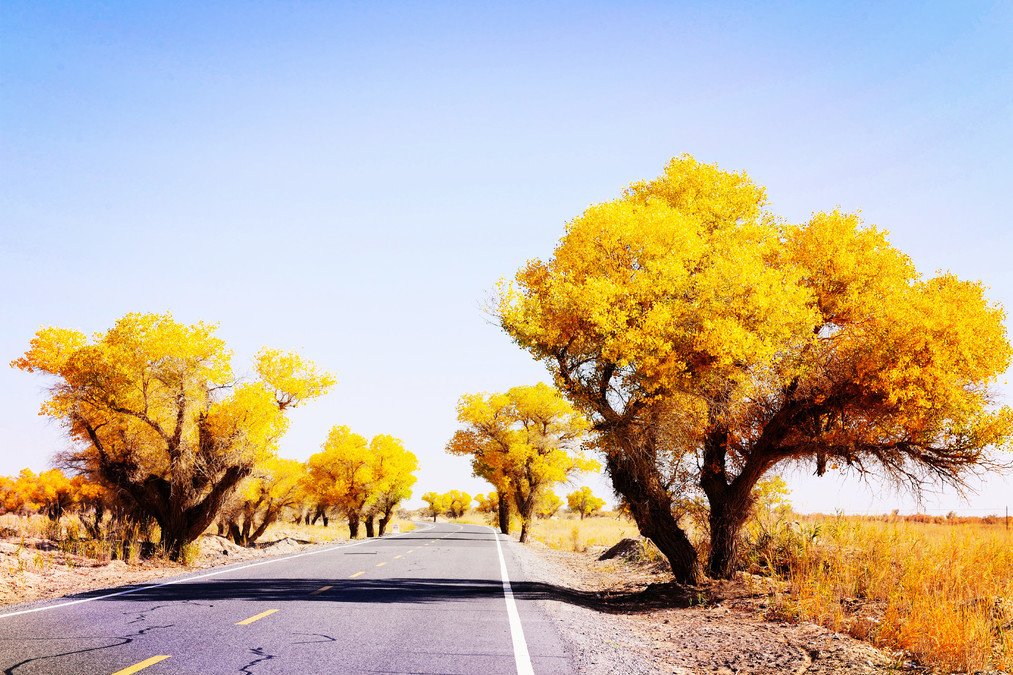
I couldn't help stopping to take photos. It was a vast area. Although it wasn't as densely and towering as the poplar forest park in Tarim River, it was better because the weather was fine today and the air was clearer than the previous day. The sky was also a deep blue. The leaves of the poplar trees were at their most beautiful time. It seemed that they had accumulated all their strength for a year and were now blooming with their most dazzling colors.
And it's completely free here! Haha, I like places that are not widely known. During the journey, unexpected surprises are always encountered. Sometimes the most beautiful scenery is not at the destination but along the way.
After leaving the poplar forest in the desert, we continued our journey. Today's itinerary was quite hectic. Because there were very few towns, service areas, or gas stations here. We wanted to cover more distance, so we didn't choose the closer areas like Minuo or Joruk, but instead made our way all the way to Huotugou, which is 1200 kilometers away from Hotan.
When you reach Huozhuogou, you have entered Qinghai. It is the closest Qinghai town to the border between Xinjiang and Qinghai. Although it is not very large, the living environment is still decent. When you arrive at night, you can truly feel that you have reached Qinghai. It is much colder than Xinjiang. (⊙o⊙)
Qinghai Gergum: Gergum Poplar Forest and Chalhan Salt Lake
----------------------------------------------
DAY12
Hua Tujiao - Geermu: 405 km
Geermu - Chalhan Salt Lake: 105 km
Chalhan Salt Lake - Delinah: 275 km
Scenic spots: Geermu Poplar Forest, Chalhan Salt Lake, Xiachedan Lake
----------------------------------------------
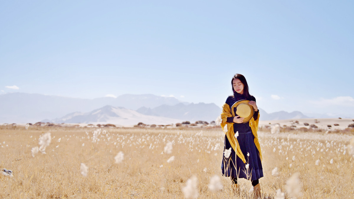
Finally, we left the arid and dusty area of the southern Xinjiang where the sand clouds always obscured the view of the blue sky and white clouds. When I woke up in the morning, I felt that the air had become much fresher. After all, it's the Qinghai Plateau. My whole being seemed to brighten up along with this clear sky. In the morning, I had a large bowl of Lanzhou noodles at the hotel entrance, and then continued on my journey, accompanied by the beautiful scenery of the blue sky and the plateau.
On the entire journey to Golmud, one could see the autumn scenery on both sides, patches of golden yellow. I felt as if this city was warmly welcoming its visitors.
We had lunch in Geermu at noon and then headed to the Geermu Populus Sylvestris Forest Scenic Area. The scenic area is about 60 kilometers away from the Geermu city center. There are no buses available here. For independent travelers, you can choose to hire a car to go there. The cost is approximately 50-60 yuan for a round trip. Apparently, many people come here to take pictures of the night sky. The night sky in Qinghai is very beautiful and it's also easy to find places with wide views and no light pollution. But you should know that it's really really really cold at night during this season. So I decided to move this activity to the summer of some future year
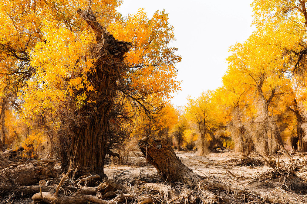
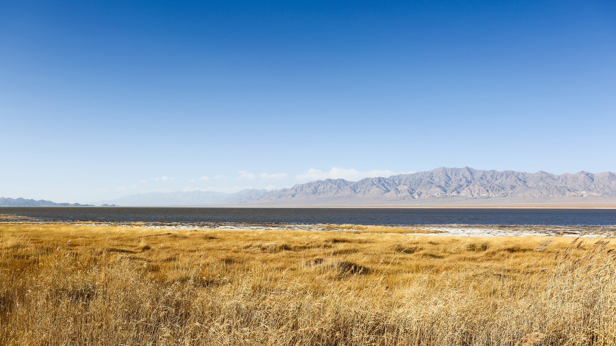
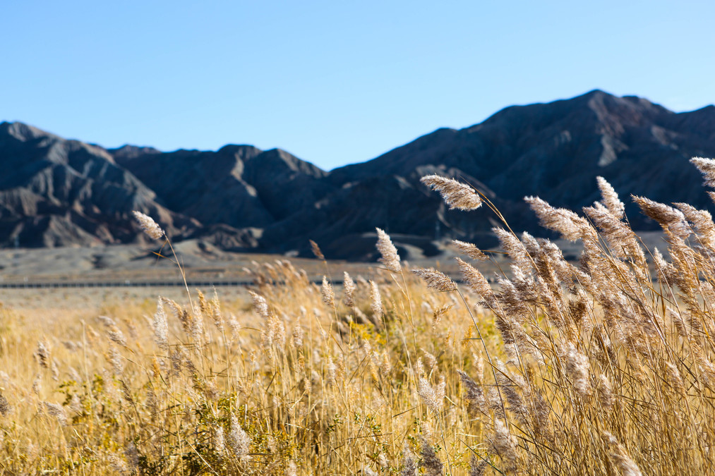
The Gergun Poplar Forest is located in the northwest of the Altun Kuruk Grassland, in the Tolei Lake area named after the Tolei River. Tolei Lake in Mongolian means "a place with many poplars". This is the only poplar forest in Qinghai Province and also the highest-altitude poplar forest in the world. Online sources say the best time to enjoy it is from early to mid-October. When we came here, it was a few days later than the optimal time, and all the poplar leaves had fallen, leaving only bare branches in the sandy desert. The scenic spot doesn't charge an entrance fee.
This area of poplar forest is located south of the towering Kunlun Mountains and north of the vast salt desert. Situated in the midst of this desertified zone, it is particularly precious. The poplar forest here used to be very lush, stretching for dozens of miles. However, it was extensively cut down in the 1960s and 1970s, and has since become sparse. The young trees that have grown later have not yet reached maturity.
Those newly grown poplars were not artificially planted. Instead, they emerged from the re-growth of the old roots of the burned and cut-down poplar trees in areas along the river and in low-lying areas with abundant moisture. This clearly demonstrates the tenacious and vigorous nature of the poplar tree. In this area where the desert has already engulfed everything, they have become a green barrier, effectively preventing the expansion of the desert and its advancement towards the northern saline-alkali land areas.
Although the beautiful poplars cannot be seen, this vast grassland, along with the sand dunes and the distant continuous snow-capped mountains, also presents a very picturesque scene. The overall color scheme is harmonious and full of depth.
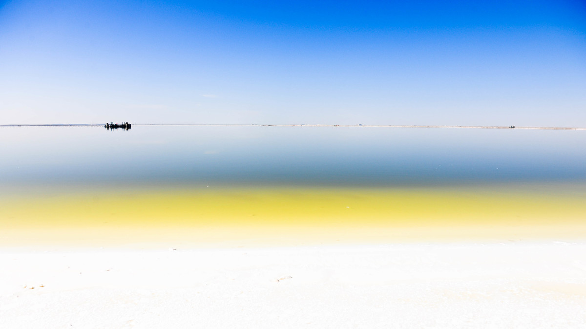
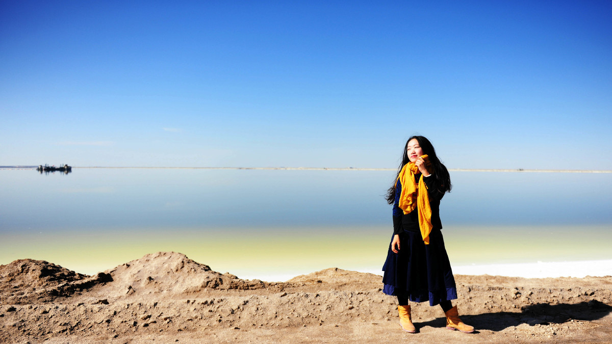
It was a bit of a pity that we couldn't visit the Chaka Salt Lake (under maintenance) when we arrived in Qinghai. So we took a detour and went to the Chaerhan Salt Lake instead. This place is not a tourist attraction; it's actually a chemical plant. You don't need to pay to enter, but you have to register. Once inside, we were completely lost and didn't know which way to go. There were all kinds of chemical plant equipment on and around the salt lake. So we just wandered aimlessly along the lake edge.
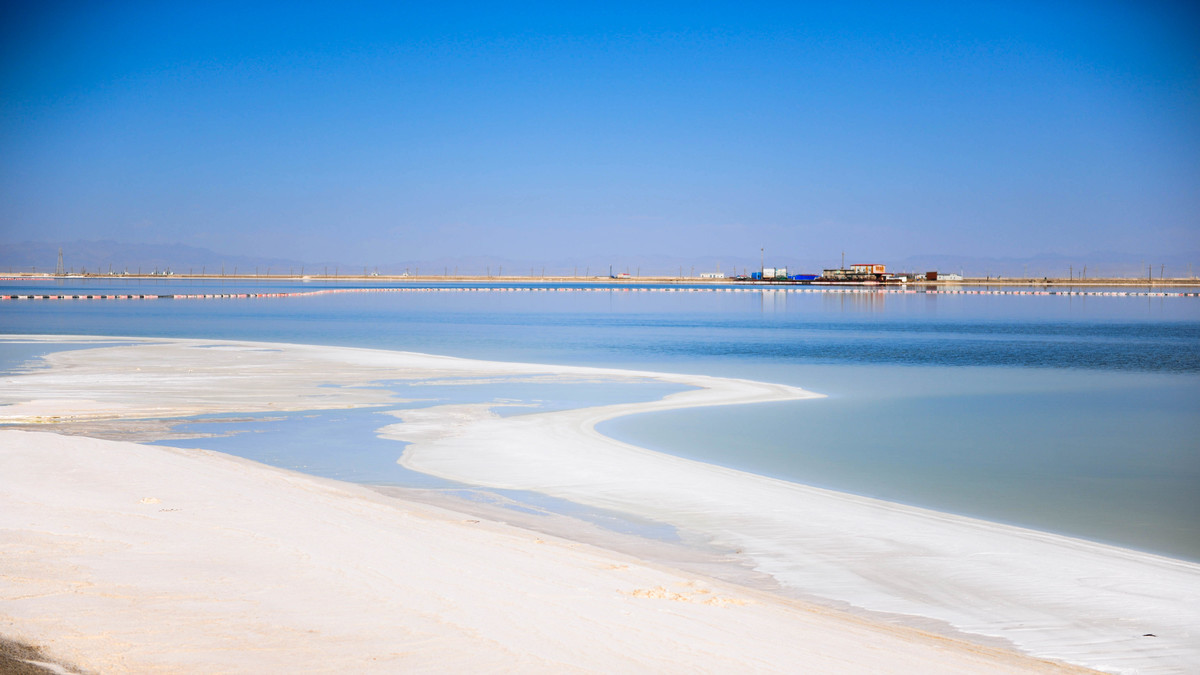
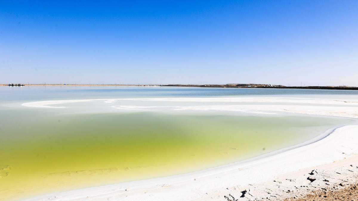
The Chalhan Salt Lake is located in the Qaidam Basin in the west of Qinghai Province. It is the largest salt lake in China and one of the most famous inland salt lakes in the world. The lake contains over 5 billion tons of sodium chloride, which is sufficient for the entire world's population to consume for 1,000 years.
"Chalhan" in Mongolian means "salt lake". The climate here is hot and dry, with long hours of sunlight and a much higher evaporation rate than precipitation. Over time, a high concentration of brine forms in the lake, gradually crystallizing into salt grains. In some areas, the lake bed has formed a thick layer of salt covering, which is extremely hard. The most astonishing thing is that a 32-kilometer-long road and railway can be built on this solid salt cover, one part of the Gergong-Dunhuang highway and one part of the Qinghai-Tibet Railway.
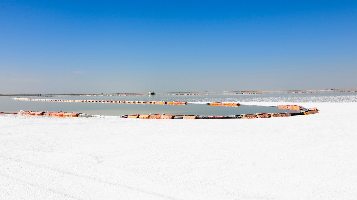
The salt lake is not managed as a scenic area, so we can only see a small part of it. We can't walk onto it like we do at Tachak Salt Lake. Most of it is deep water covered with salt. But for some reason, the color of the lake surface in some areas has very rich and beautiful layers, and there is a kind of hazy and dreamlike feeling.
After leaving Salt Lake, we headed to De'linha. At the junction of the De'ling Expressway and the Liuguo Expressway, we also visited Xiaochaidan Lake. Compared to Qinghai Lake, this one is simply a small puddle. But since we didn't go to Qinghai Lake - everyone thought that Qinghai Lake without the yellow rape flowers wasn't worth visiting.
After strolling by the lake, we drove directly to De'lingha and stayed there for the night. Then the main task was to continue our journey back to Beijing.
----------------------------------------------
DAY13
Delingha - Huzhu: 612 km
Huzhu - Dingbian: 682 km
Just traveling without stopping
----------------------------------------------
Today, I originally planned to make a stopover and visit the Huzhuibei Mountain National Forest Park in the north of Xining. From the pictures, I could see that the autumn scenery there was extremely beautiful. However, due to the road construction not being completed, I had to return and continued eastward to stay in Dingbian.
Xinzhou, Shanxi Province: Foguang Temple
----------------------------------------------
DAY14
Dingbian - Fuguang Temple: 684 km
Fuguang Temple - Beijing: 368 km
Attraction: Fuguang Temple
----------------------------------------------
We set off from Dingbian in the morning, planning to make a one-ride journey back to the capital. Along the way, I also insisted on visiting the Fugong Temple in Wutai Mountain. You know, this is the Parthenon in the hearts of all architecture students!
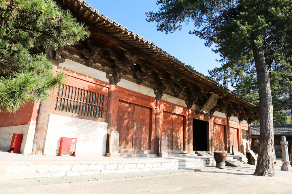
The eastern hall of Foguang Temple is the oldest and most typical example of the abbotial structure architecture of the Tang Dynasty that still exists in China. The structure of the hall is composed of three parts: the deep column grid, the laying layer, and the roof beam frame. The seven-layered purlin arches are sprawling and imposing, exerting a powerful pressure in all directions. It is the only example among the existing ancient Chinese buildings where the number of layers that the arches extend outwards is the highest and the distance is the farthest. It is also a unique instance in China that integrates Tang Dynasty architecture, painted sculptures, murals, inscriptions, and stelae in one hall.
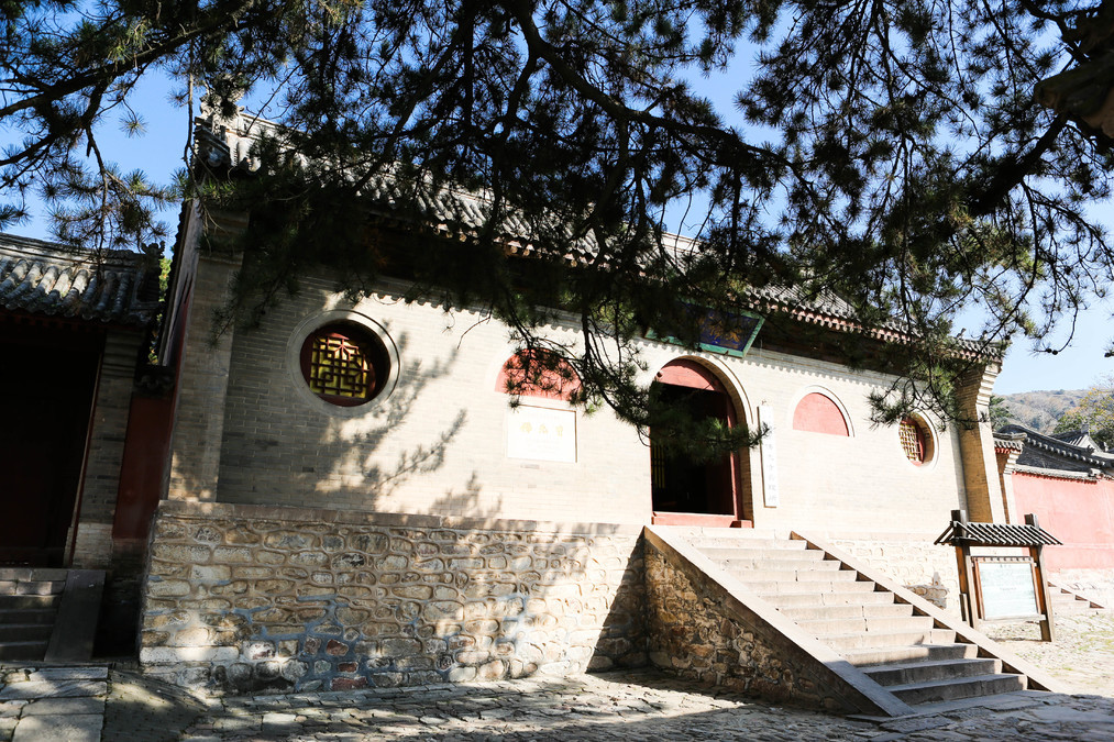
In fact, Foguang Temple was originally built during the reign of Emperor Xiaowen of the Northern Wei Dynasty (471 - 499 AD). Later, it was destroyed during the Buddhist suppression campaign in the fifth year of Emperor Wuzong's reign of the Tang Dynasty (845 AD). In 847 AD, Emperor Xuanzong Li Chen of the Tang Dynasty ascended the throne, and Buddhism was revived. Thus, Foguang Temple was rebuilt. My idol Lin Huiyin and her husband discovered this astonishing architectural wonder based on a mural left in Dunhuang. That painting depicted the original two-story Buddhist temple from the Northern Wei Dynasty.
Foguang Temple is truly fortunate. Because of its remote location, it avoided the Western powers during the late Qing Dynasty, the Japanese invaders during World War II, and also because it was listed as one of the first batch of national key cultural relics protection units in 1961, it also avoided the Cultural Revolution. Thus, it has been incredibly lucky to survive until today.
Chinese tourists tend to visit places briefly and leave quickly. However, several French tourists took the time to listen to the detailed explanations provided by the guides, then found a quiet corner to take notes, either recording their thoughts or sketching some simple landscapes. Perhaps we should also learn this kind of travel style.
There are a large number of ancient buildings left in Shanxi. It is said that about 70% of the ancient buildings in China are located in Shanxi. Previously, I have visited some representative places in Shanxi. It's too late now to visit Nanzhen Temple. Maybe in the future, I will gradually follow the footsteps of Liang Sicheng and Lin Huiyin and explore all the ancient buildings in Shanxi!
There are currently only four wooden-structured Tang Dynasty buildings remaining in China:
1. Nan Chan Temple, Wutai County, Shanxi Province, the main hall was built in the third year of Jianzhong era of Emperor Dezong of Tang (AD 782)
2. Guangren Wang Temple, Ruicheng County, Shanxi Province, the main hall was built in the fifth year of Daera era of Tang (AD 831)
3. Fuguang Temple, Wutai County, Shanxi Province, the main hall was built in the eleventh year of Dachong era of Tang (AD 857)
4. Tiantai An Temple, Pingshun County, Shanxi Province, built in the fourth year of Tianwu era of the Tang Dynasty (AD 907)